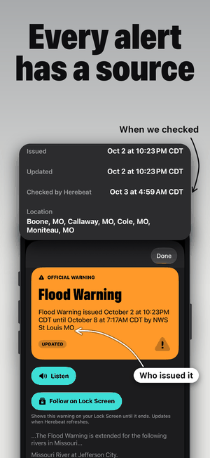
Named on every item.
Each alert shows the agency that issued it, such as the National Weather Service office for your area. Herebeat doesn’t write its own warnings.
 herebeat.
See pricing
herebeat.
See pricing
New in Herebeat 1.1
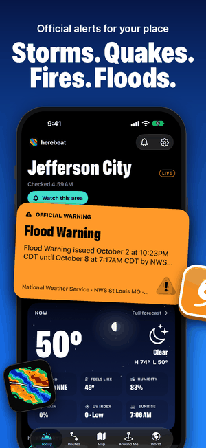
Official alerts for your place
Hurricane cones from NOAA, severe storm outlooks, warnings on your Lock Screen and a weather card that moves with your sky. Every item says who issued it and when.
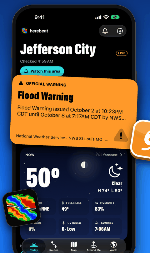
Free download, subscription required. 7-day free trial. For iPhone, with an Apple Watch app. Shown: a live National Weather Service Flood Warning for Jefferson City, MO, 3 October 2026.
The idea
When a storm forms or a river rises, the useful question is simple: what changed where I live? Herebeat brings the official alerts, forecasts and conditions for your places into one calm view, and keeps the source and time attached to every item.
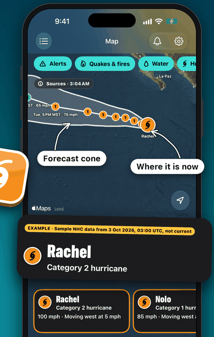
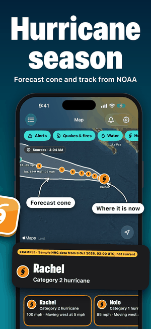
Cone and track, from NOAA
The forecast cone, track and current position from NOAA’s National Hurricane Center and Central Pacific Hurricane Center, on your map. Tap a storm for its category, wind, movement and the latest advisory.
Shown: sample NHC data from 3 October 2026, labelled EXAMPLE in the app. A cone shows the likely track of the centre, not the size of the storm.
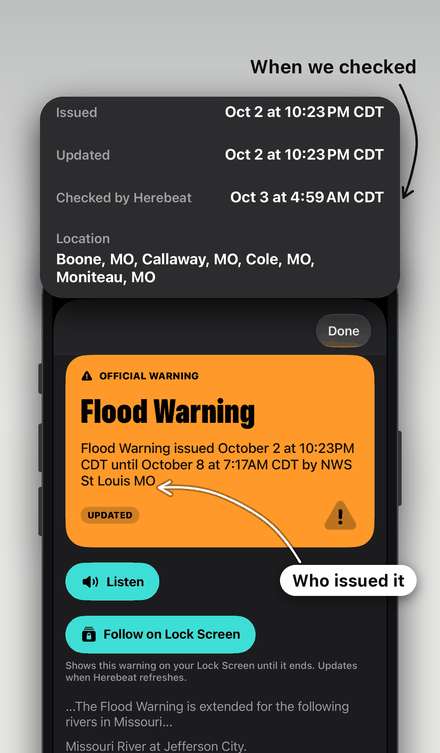
Each alert shows the agency that issued it, such as the National Weather Service office for your area. Herebeat doesn’t write its own warnings.
See when the agency issued and updated it, when Herebeat last checked, and one tap to the original.
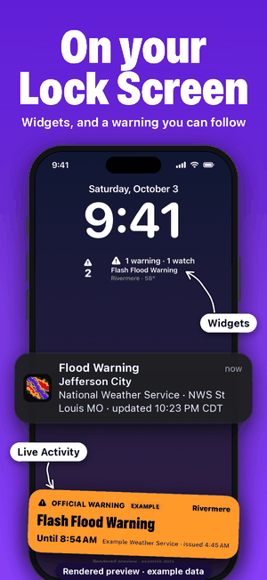
Put a warning on your Lock Screen as a Live Activity. It updates when Herebeat refreshes.
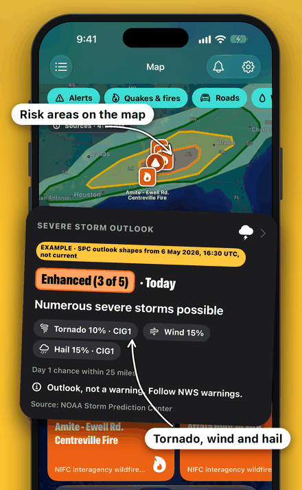
Days 1 to 3, from NOAA’s Storm Prediction Center
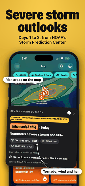
See the outlook risk level for your place, with the chance of tornadoes, damaging wind and hail, and the outlook areas on the map. In the US.
An outlook isn’t a warning; follow NWS warnings. Shown: SPC outlook shapes from 6 May 2026, labelled EXAMPLE in the app.
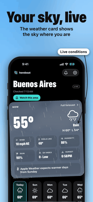
The weather card moves with the conditions where you are: rain, snow, night or storms, from Apple Weather. Radar and next-hour rain sit right next to your alerts.
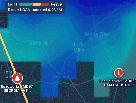
NOAA radar on your map, in the US, with the time it was updated.
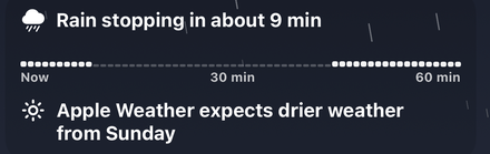
When rain starts or stops in the next hour, where Apple Weather has minute-by-minute data.
Shown: live data from 3 October 2026 for Buenos Aires and Washington, DC.
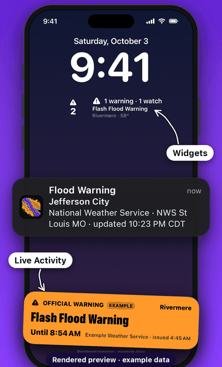
Widgets, and a warning you can follow
Home and Lock Screen widgets show what’s active at your places. A Live Activity follows an official warning until it ends, and updates when Herebeat refreshes.
Shown: a rendered preview with example data. The notification is drawn with the text Herebeat sends for the Jefferson City Flood Warning.
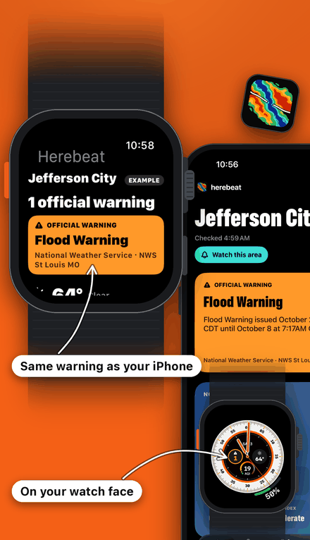
Alerts, weather and air on Apple Watch
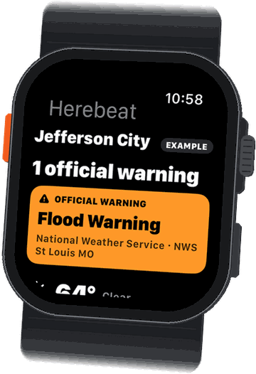
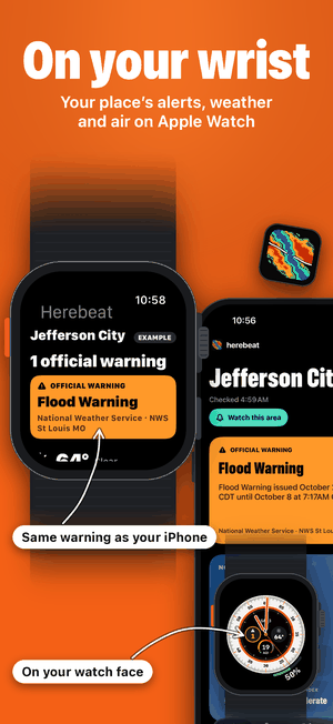
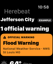
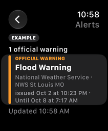
The Apple Watch app shows the warnings, temperature and air quality for your places, from your iPhone. Add Herebeat complications to your watch face.
Shown: Apple Watch screens from the watchOS simulator, replaying the Jefferson City Flood Warning (marked EXAMPLE on the watch). The watch case and band are drawn.
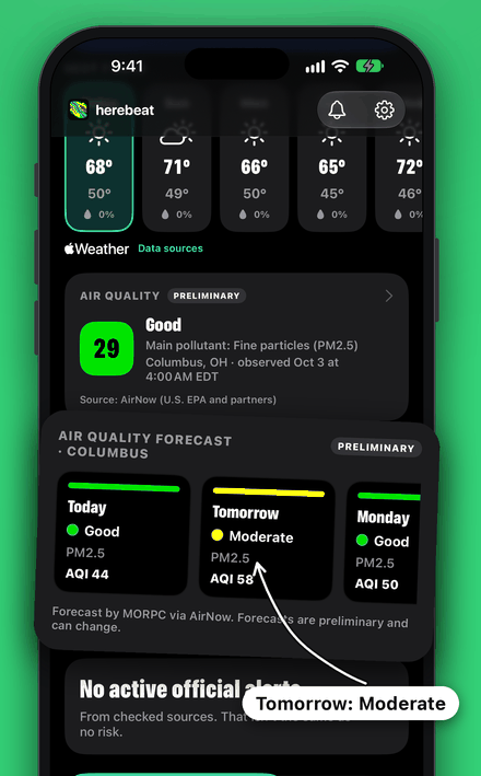
Right now and the days ahead
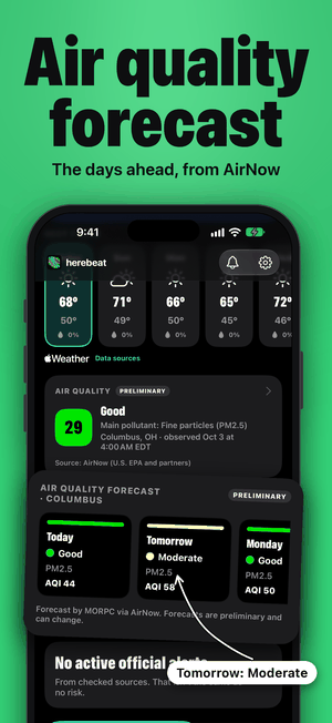
The AirNow reading and forecast for your place in the US, in the EPA’s colours, marked preliminary as AirNow publishes them. Elsewhere, nearby monitors through OpenAQ, marked as estimated.
Shown: live AirNow data for Columbus, OH, 3 October 2026.
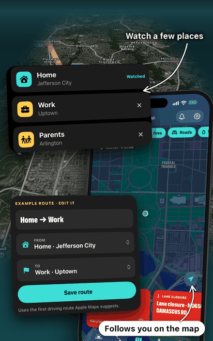
Home, work, family, and the drive between
Watch a few places and save the routes you drive. Herebeat looks for road reports and regional alerts along each one and shows when it last checked. The location button keeps the map following you.
Example places and route shown. Road coverage varies by area.
No report doesn’t mean a road is clear.
Spin the globe or search a town
Pick your place on the globe, search a town or ZIP code, or use your location. Herebeat watches the area around it.
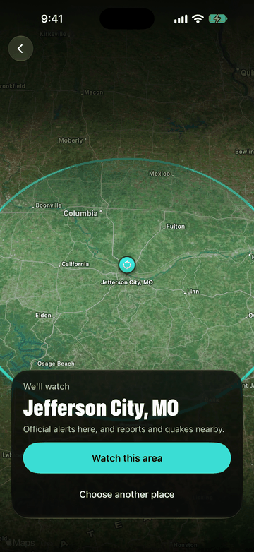
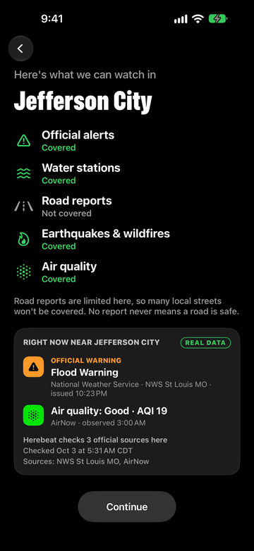
What’s covered, and what’s happening, before you pay
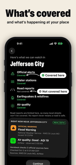
Coverage varies by place. Before you choose a plan, Herebeat shows what it can watch in your town and the real alerts and air quality there right now.
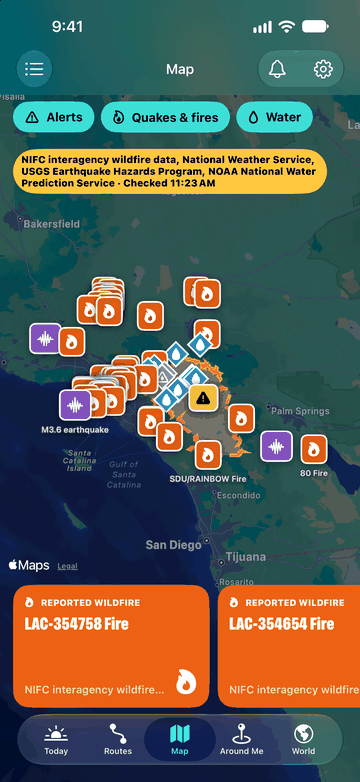
Fires, quakes and water levels
Official alerts, earthquakes from USGS, wildfires from NIFC and river gauges share one map, with filters to narrow it down. Switch to World for earthquakes, storms and floods around the globe.
Shown: real data around Riverside, CA.
A weather service, a seismic network or another public agency publishes an alert.
We match it to your place and drop duplicates.
In plain words, with who issued it and when.
Calm notifications
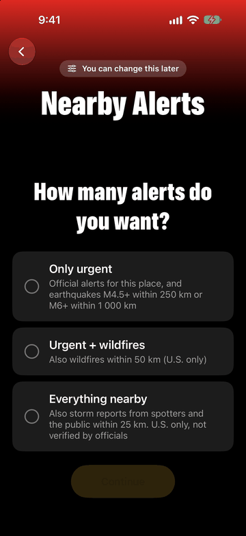
You choose how much to hear about. Herebeat keeps notifications quiet by design, and they come with your subscription.
Herebeat is not an emergency alert system. Keep your iPhone’s government emergency alerts turned on.
App Store preview
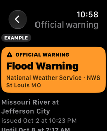
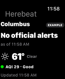
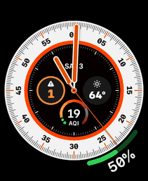
Hurricane and outlook images use labelled sample data so the features can be shown outside an active storm; the Lock Screen image is a rendered preview with example data. The Apple Watch screens replay the Jefferson City Flood Warning and are marked EXAMPLE on the watch. Everything else is live data or a real server answer from 3 October 2026.
Pricing
Free to download. A subscription unlocks everything, starting with a 7-day free trial.
$39.99 / year
About $3.33 a month · 7-day free trial
$7.99 / month
7-day free trial
Billed through the App Store in US dollars; prices may differ by country. Cancel anytime in Settings. Coverage varies by place, and the app shows it before you pay. Storm outlooks, radar and the air quality forecast are for the US, and hurricanes come from NOAA’s Atlantic and Pacific hurricane centers.
Herebeat for iPhone
Official alerts, hurricanes and your sky, each with its source. For iPhone, with an Apple Watch app.