App icon
1024×1024 PNG. Please use it as is, without cropping, recolouring or adding effects.
PNG, 1.0 MB herebeat.
Visit the site
herebeat.
Visit the site
Press kit
Herebeat brings the official alerts, hurricanes, storm outlooks, earthquakes, wildfires, water levels and air quality for the places you care about into one calm view. It draws on more than 50 official agencies, including the National Weather Service, NOAA’s National Hurricane Center and Storm Prediction Center, USGS, the Japan Meteorological Agency, NIFC and MeteoAlarm, and every item names the agency that issued it and when. Version 1.1 adds hurricane cones and tracks, severe storm outlooks, Home and Lock Screen widgets, Live Activities, an Apple Watch app, radar, an air quality forecast and a weather card that moves with your sky. Before you subscribe, Herebeat shows what it covers in your town and what’s happening there right now. No account, no ads, no tracking.
Fact sheet
Key features
Herebeat 1.1: hurricanes, storm outlooks, the Lock Screen and Apple Watch, on top of the alerts, map and routes from 1.0.
Forecast cone, track and current position from NOAA’s National Hurricane Center and Central Pacific Hurricane Center, with each storm’s category, wind, movement and latest advisory.
Days 1 to 3 from NOAA’s Storm Prediction Center, with tornado, wind and hail chances. US only. An outlook isn’t a warning.
Who issued it, when it was issued and updated, when Herebeat last checked, and one tap to the original. Herebeat doesn’t write its own warnings.
Home and Lock Screen widgets, and a Live Activity that follows an official warning until it ends.
Warnings, the temperature and air quality for your places, with watch-face complications, from your iPhone.
The weather card shows rain, snow, night or storms as they are where you are, from Apple Weather.
NOAA rain radar on the map in the US, and when rain starts or stops in the next hour where Apple Weather has minute-by-minute data.
AirNow readings and the days ahead in the US, marked preliminary as AirNow publishes them. Elsewhere, nearby OpenAQ monitors, marked as estimated.
Warnings, watches and advisories for your area, in plain words, from more than 50 official agencies.
Official alerts, USGS earthquakes, NIFC wildfires and river gauges on one map, with filters, plus a World globe of recent quakes, storms and floods.
Watch home, work and family, and save the routes you drive. Road reports appear where transport agencies publish them; elsewhere roads show as not covered.
Pick a town on the globe or search a ZIP code, see what’s covered there and what isn’t, and the real alerts and air quality there right now.
Related updates bundled, a daily limit, an “only urgent” option and quiet hours. Warnings are never held back.
Tap Listen to hear an alert in plain words. The app comes in 7 languages, with your units and time format.
No sign-up. Places stay on your iPhone unless you turn on notifications for them. Family Sharing included.
Downloads
1024×1024 PNG. Please use it as is, without cropping, recolouring or adding effects.
PNG, 1.0 MB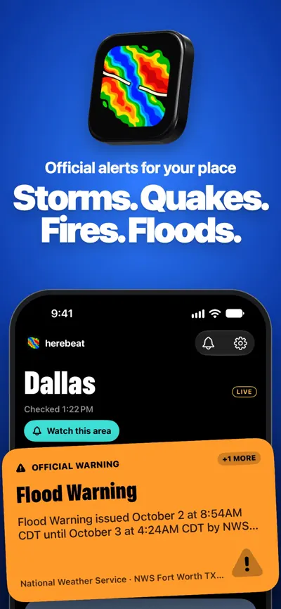
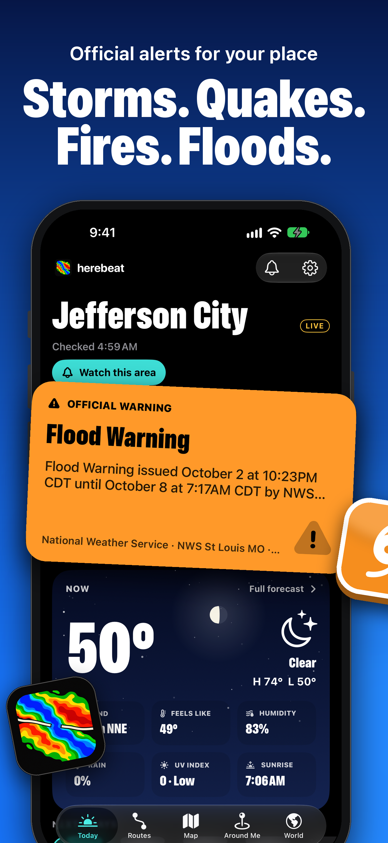
01 · Storms. Quakes. Fires. Floods.
PNG, 1320×2868, 1.1 MB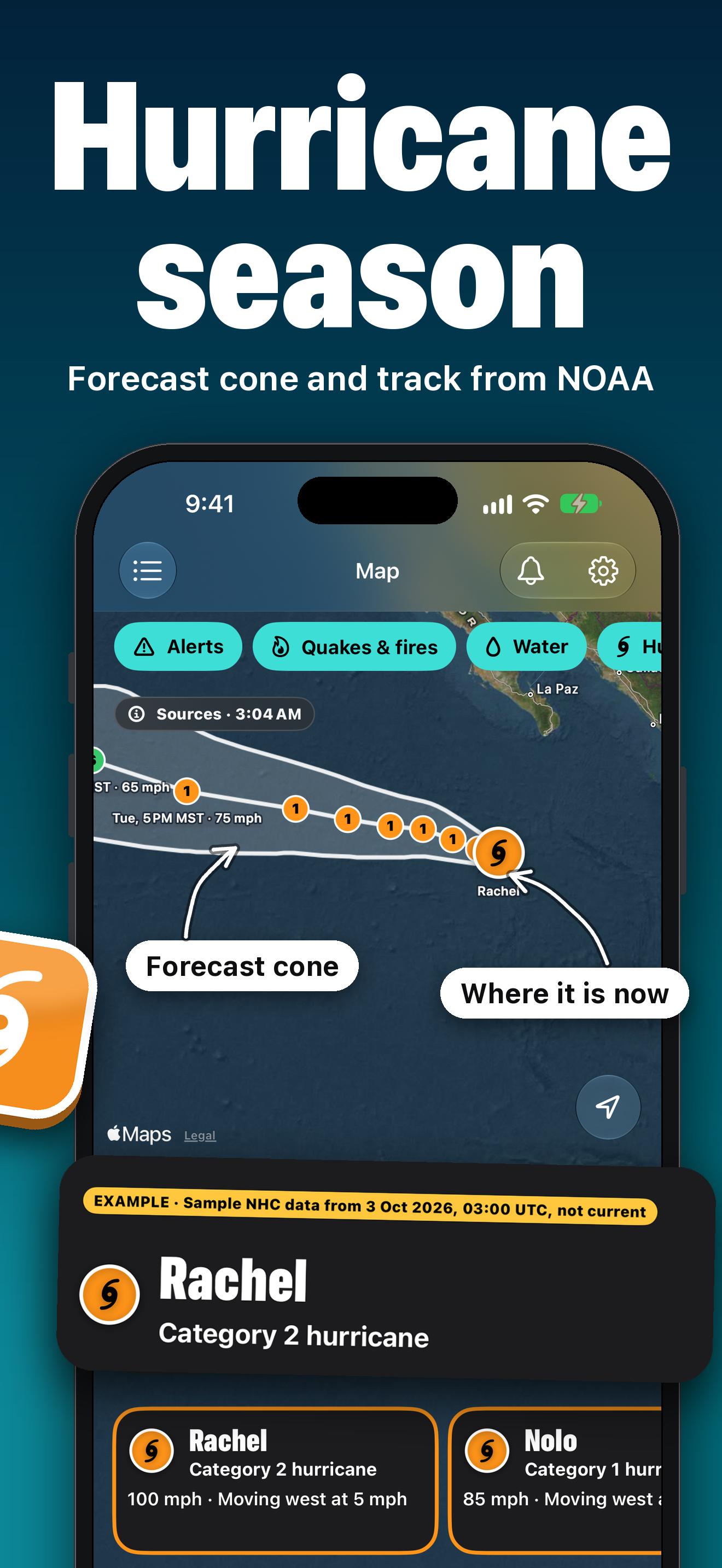
02 · Hurricane season
PNG, 1320×2868, 1.3 MB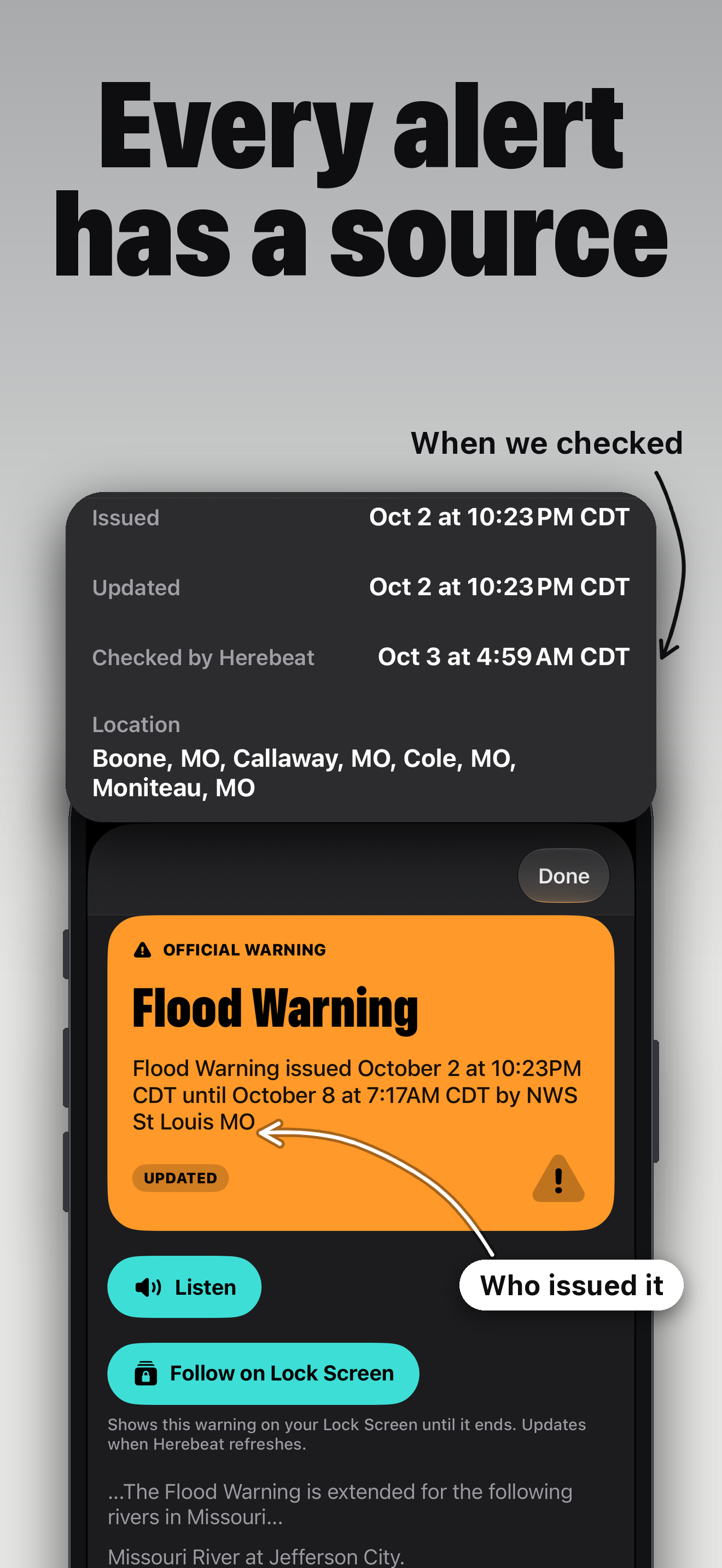
03 · Every alert has a source
PNG, 1320×2868, 0.6 MB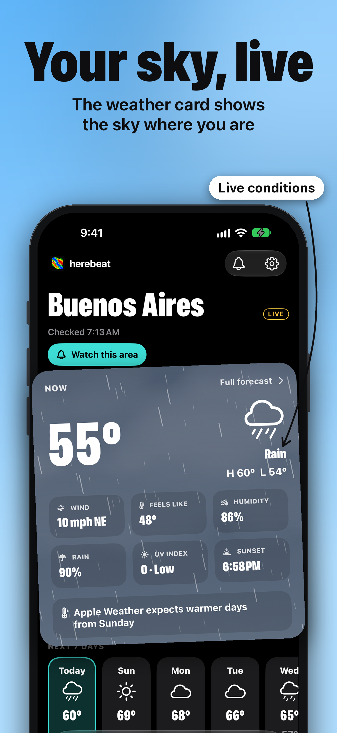
04 · Your sky, live
PNG, 1320×2868, 1.4 MB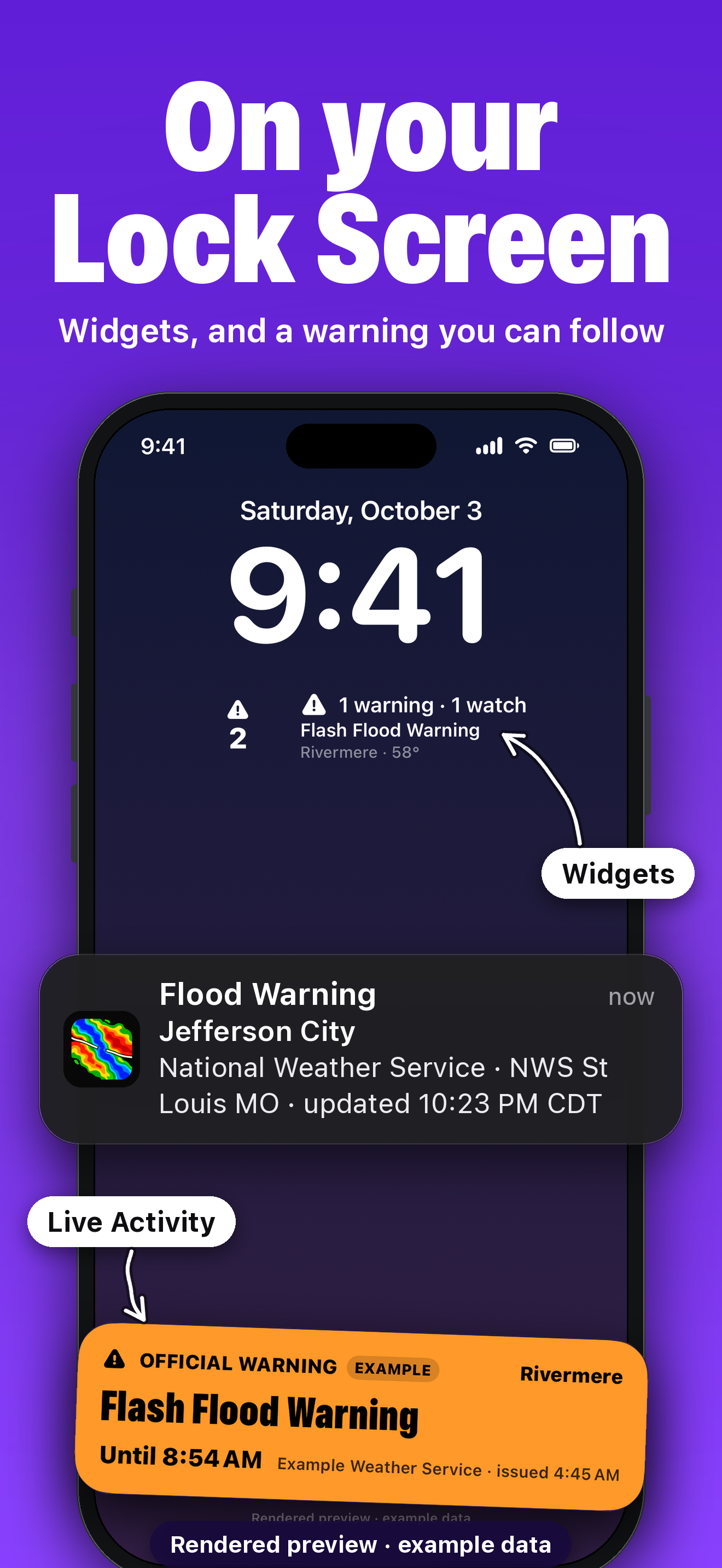
05 · On your Lock Screen
PNG, 1320×2868, 1.4 MB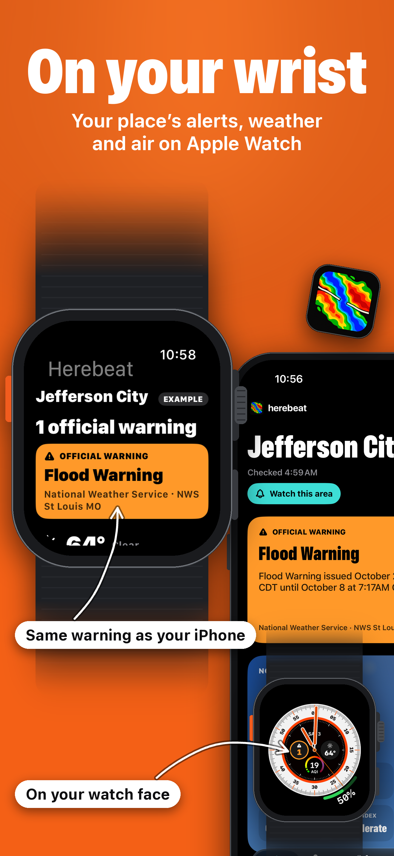
06 · On your wrist
PNG, 1320×2868, 0.8 MB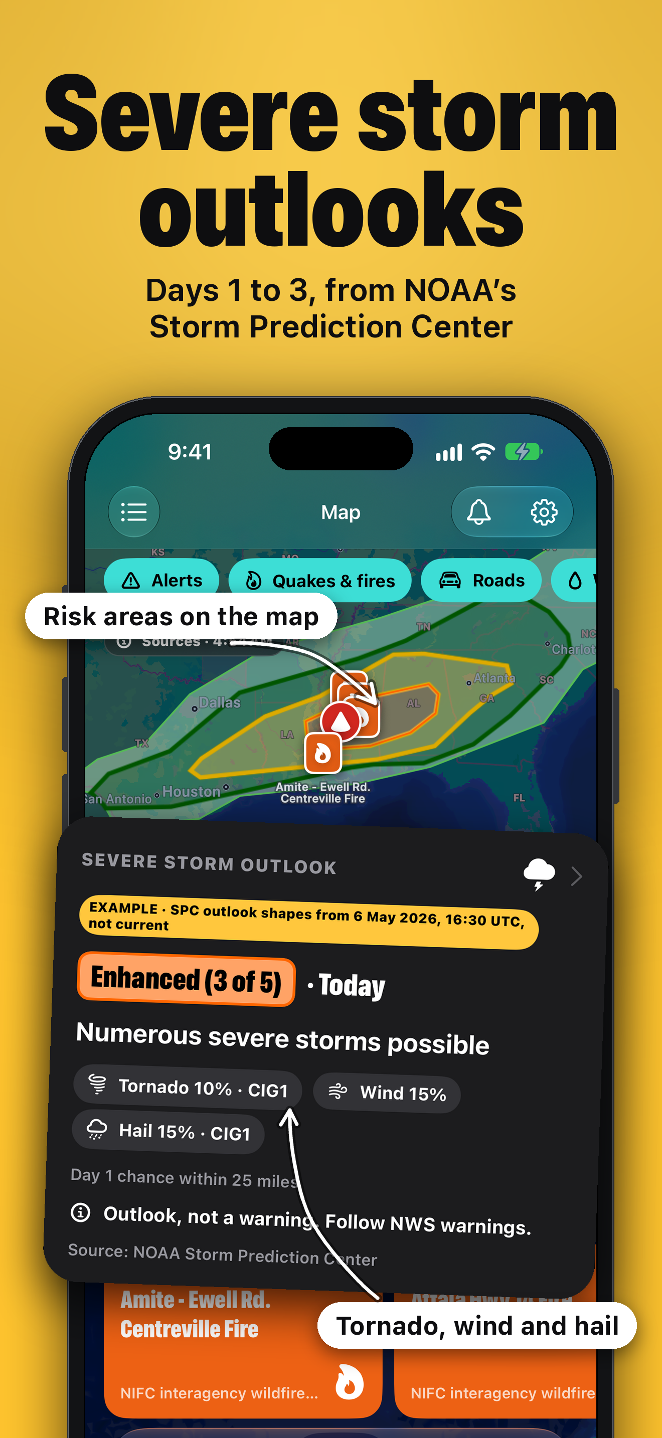
07 · Severe storm outlooks
PNG, 1320×2868, 1.2 MB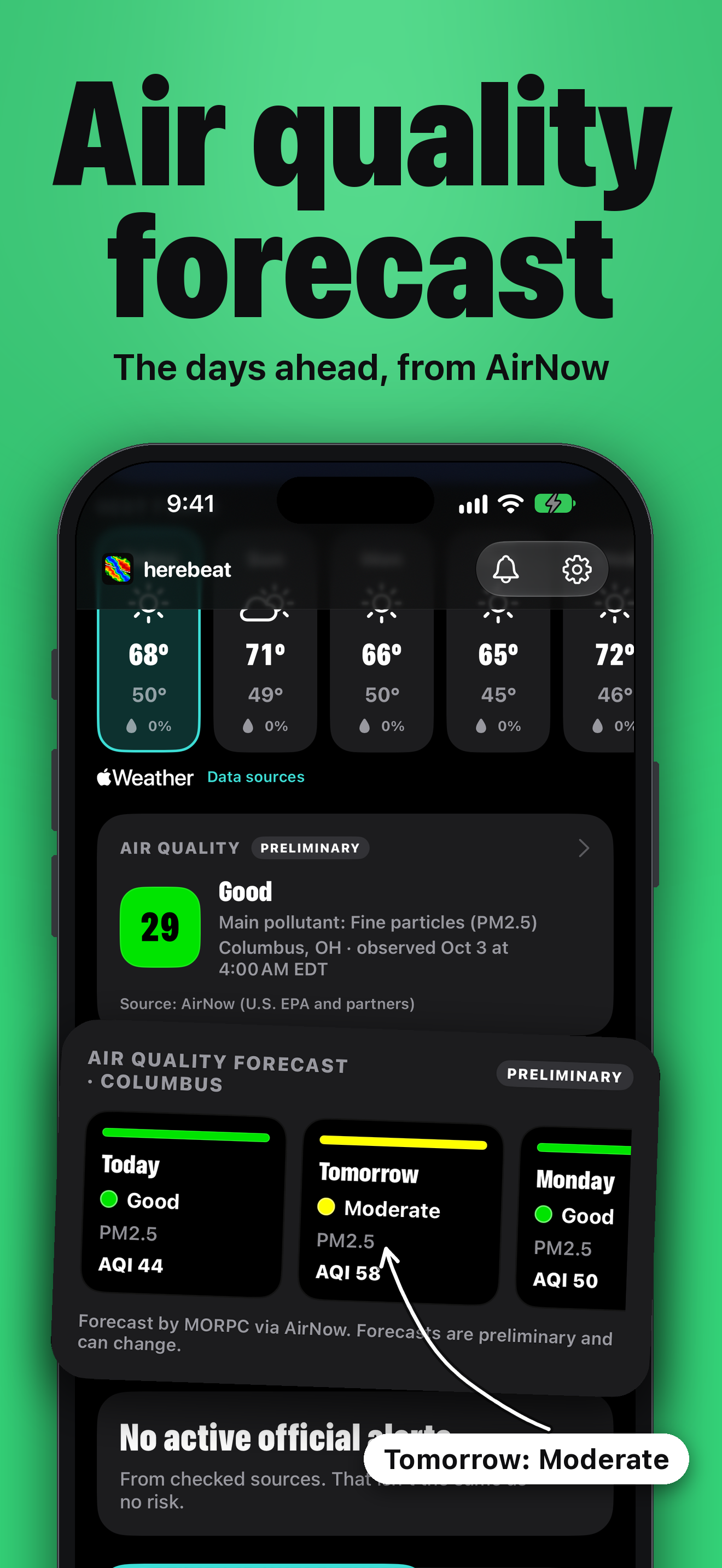
08 · Air quality forecast
PNG, 1320×2868, 0.8 MB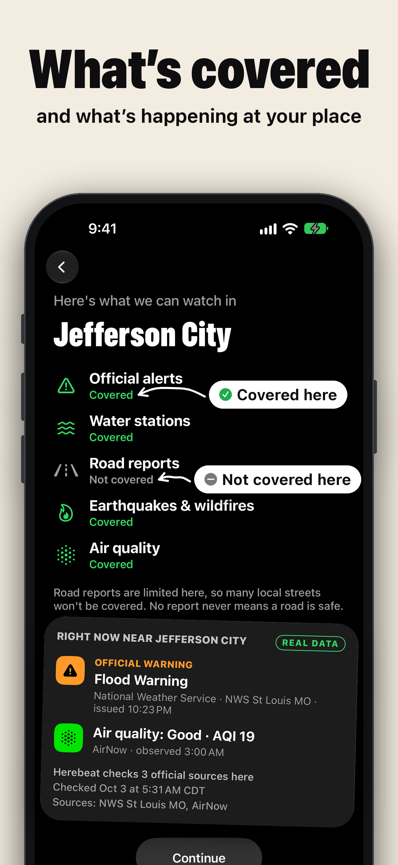
09 · What’s covered
PNG, 1320×2868, 0.6 MBThe same version in a 3D style, if it suits your layout better. Same date and labels; its storm sky also uses an example town. All nine, ZIP, 14.3 MB
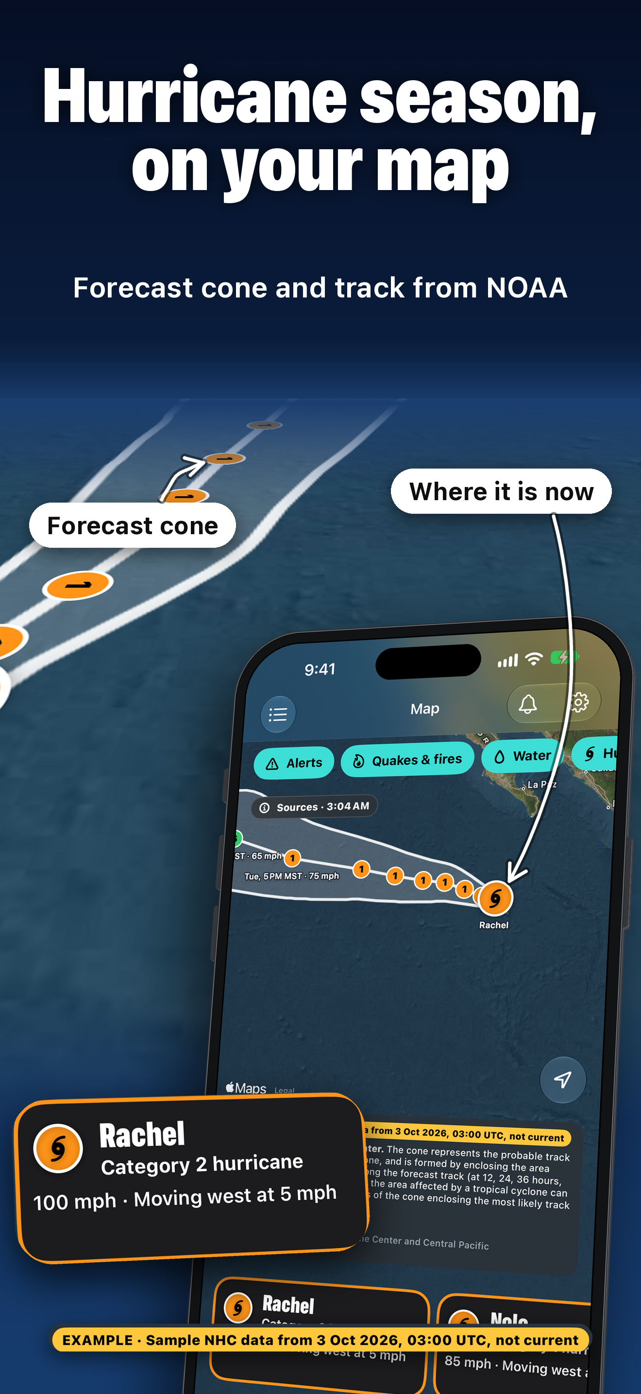
01 · Hurricane season, on your map
PNG, 1320×2868, 1.9 MB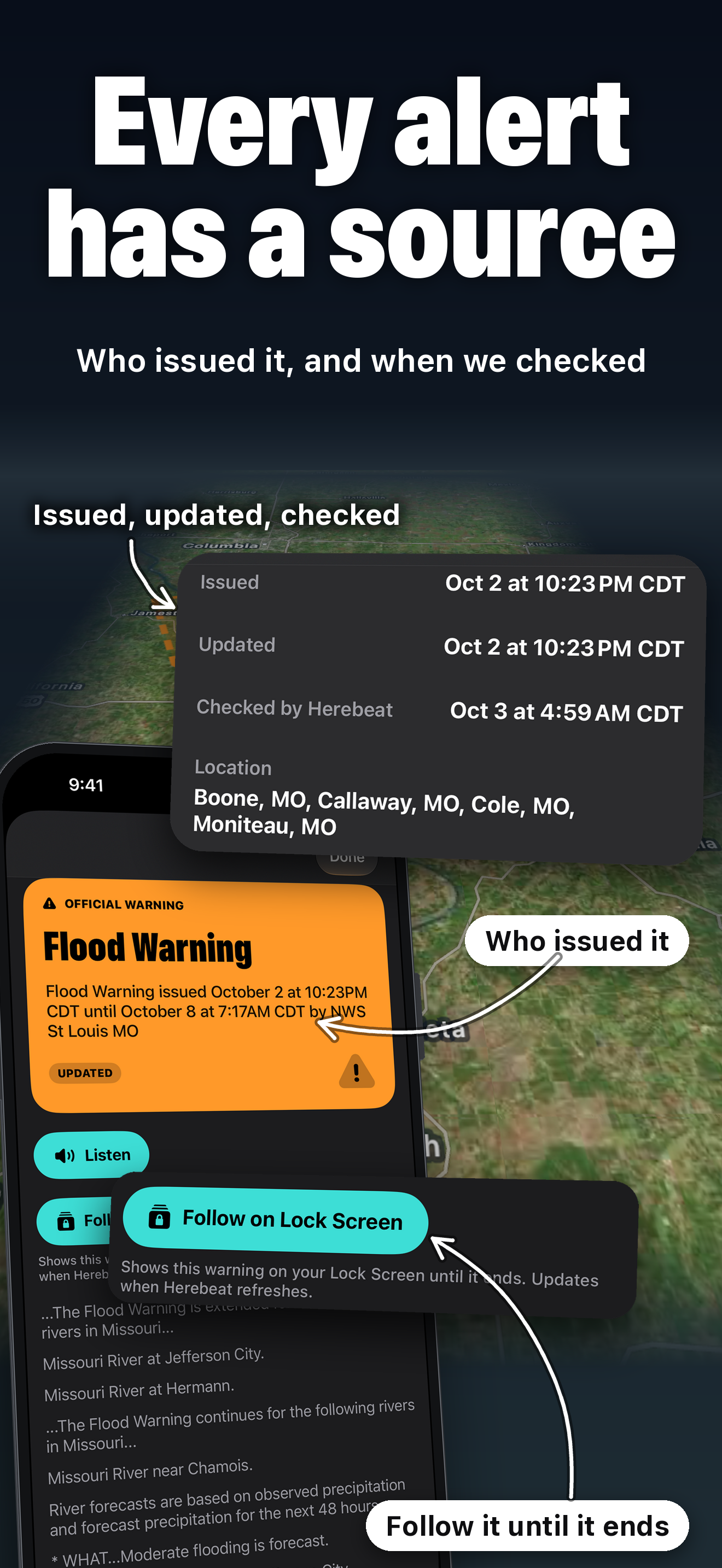
02 · Every alert has a source
PNG, 1320×2868, 1.6 MB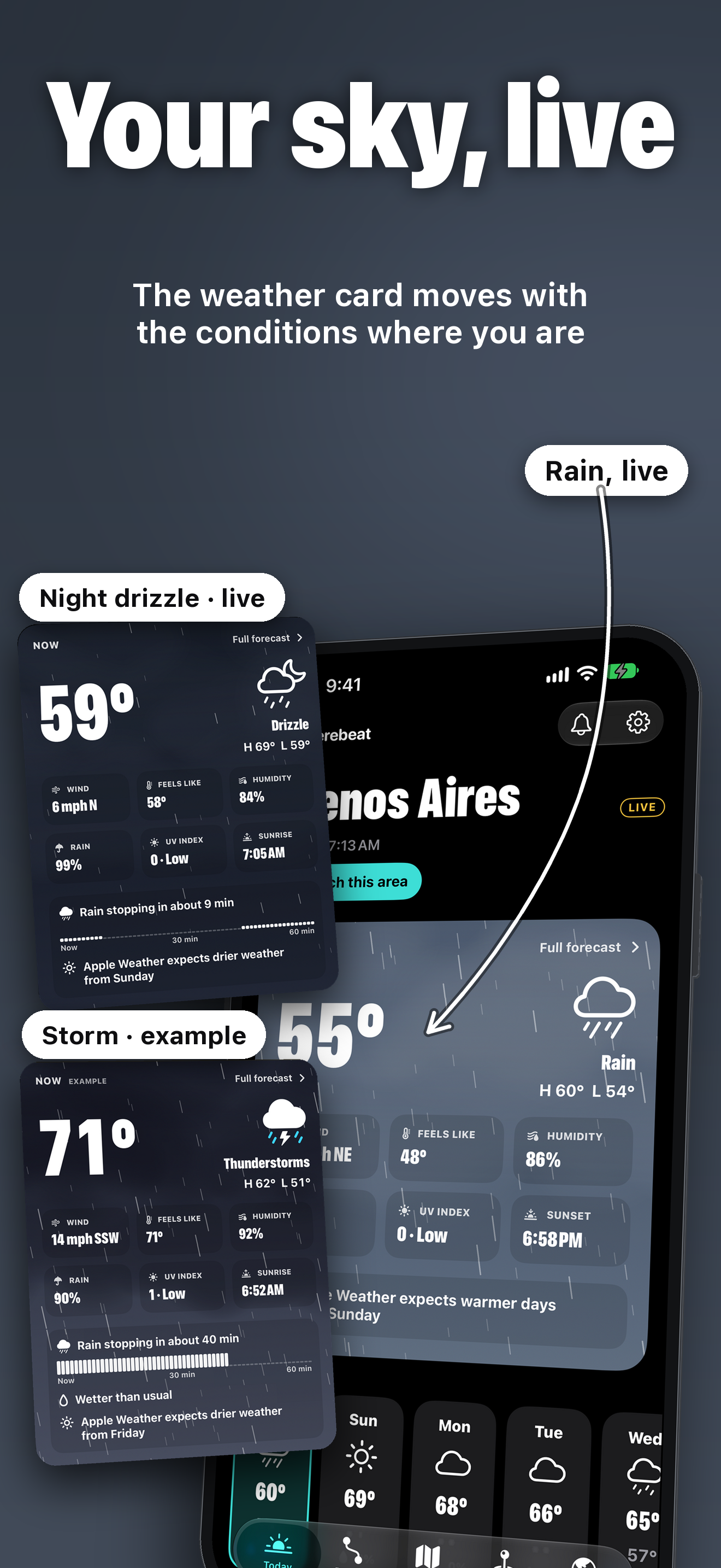
03 · Your sky, live
PNG, 1320×2868, 1.7 MB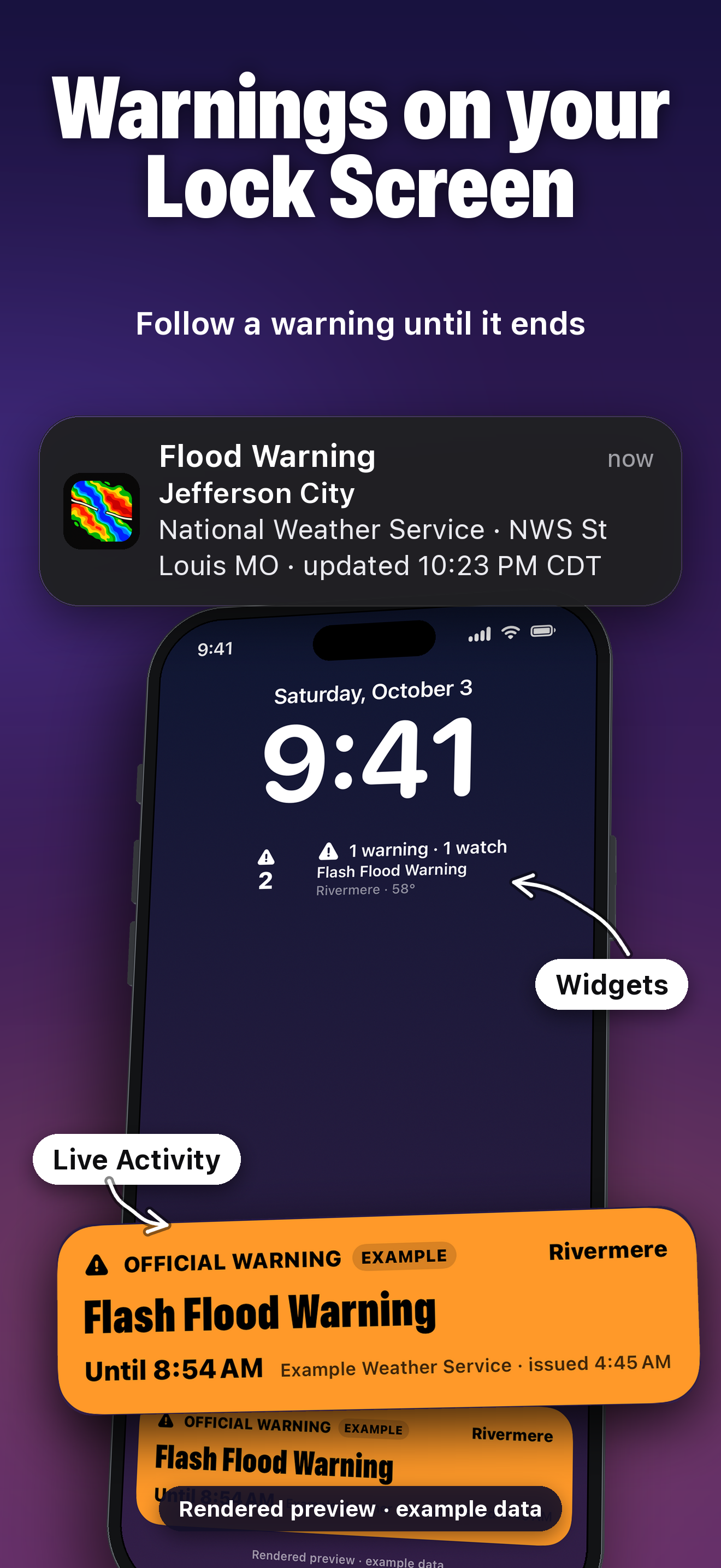
04 · Warnings on your Lock Screen
PNG, 1320×2868, 1.4 MB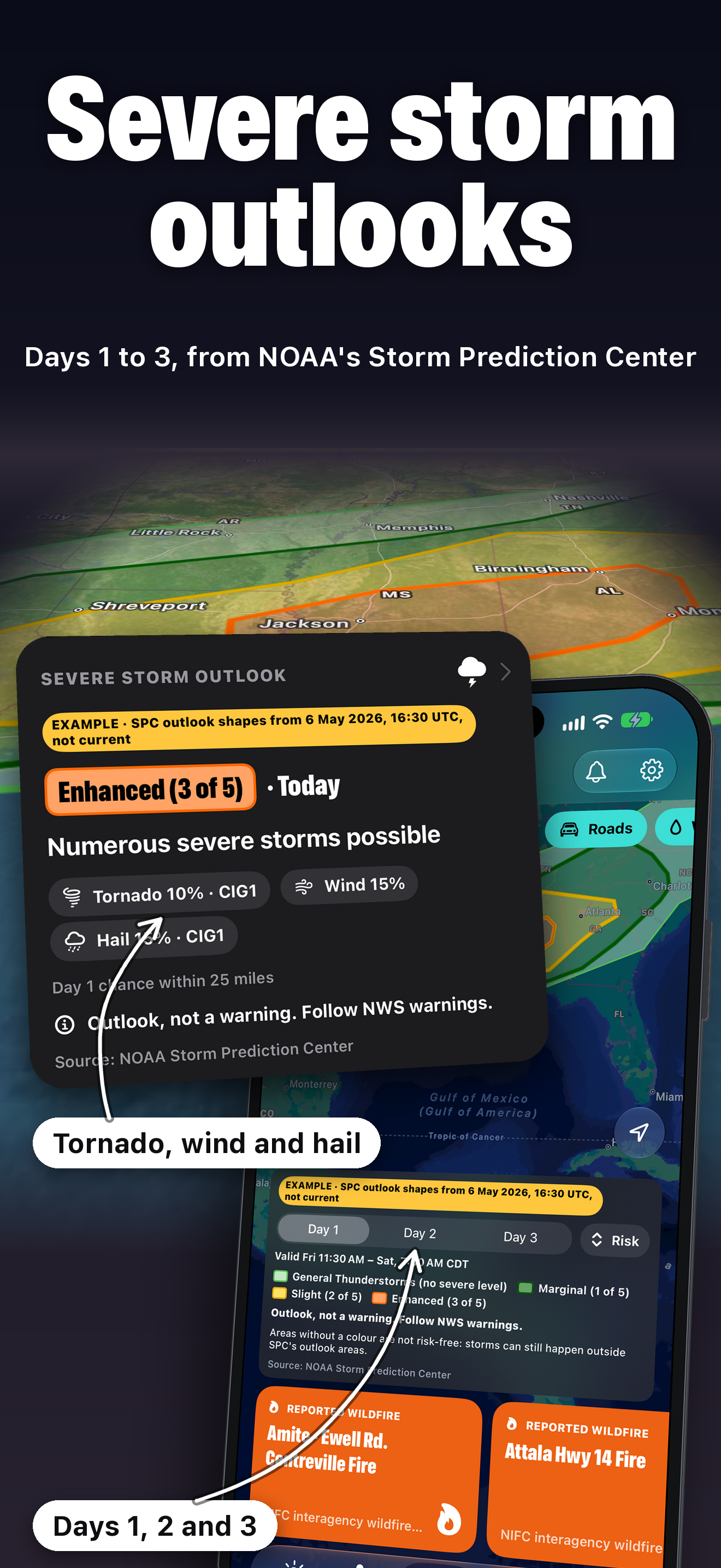
05 · Severe storm outlooks
PNG, 1320×2868, 1.8 MB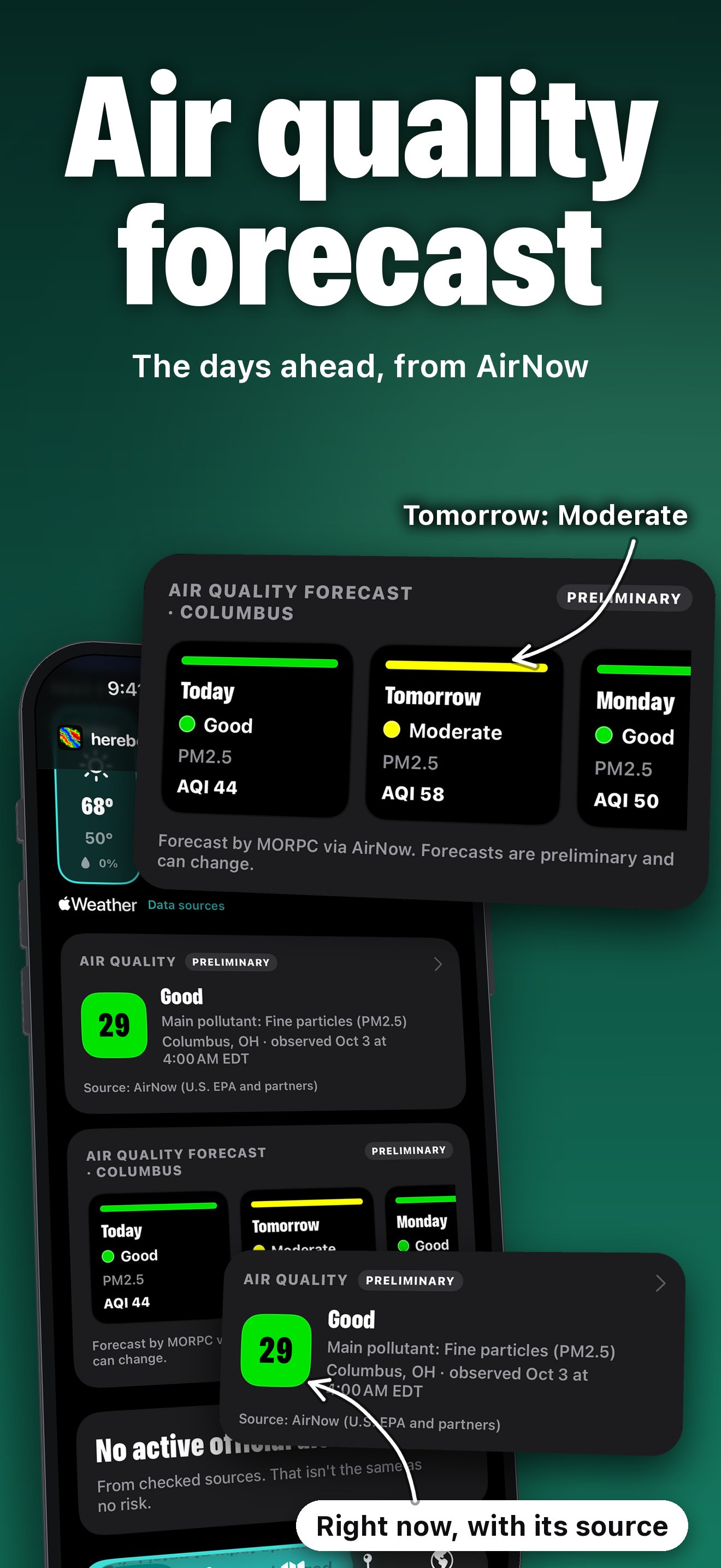
06 · Air quality forecast
PNG, 1320×2868, 0.9 MB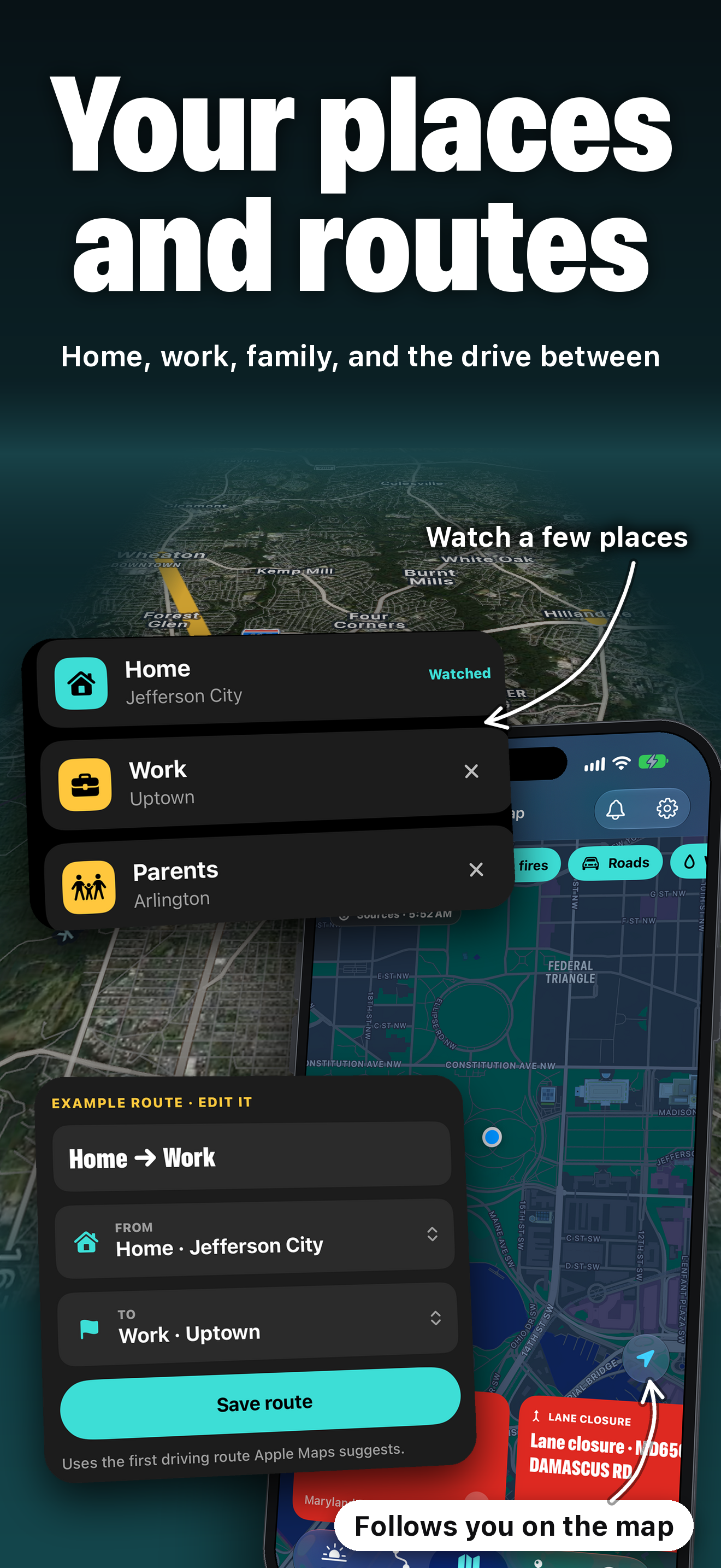
07 · Your places and routes
PNG, 1320×2868, 1.9 MB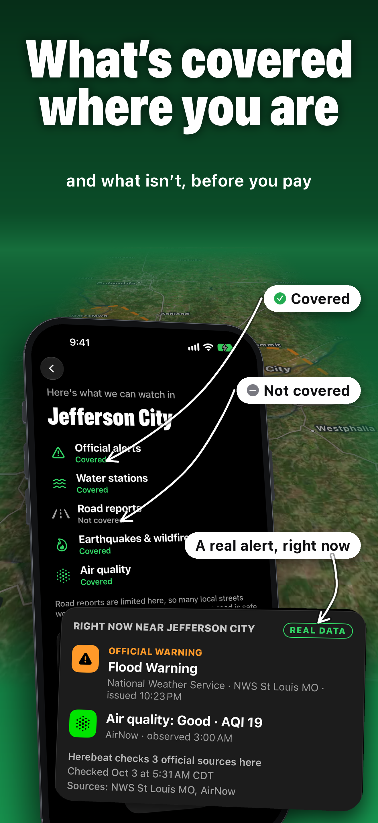
08 · What’s covered where you are
PNG, 1320×2868, 1.4 MB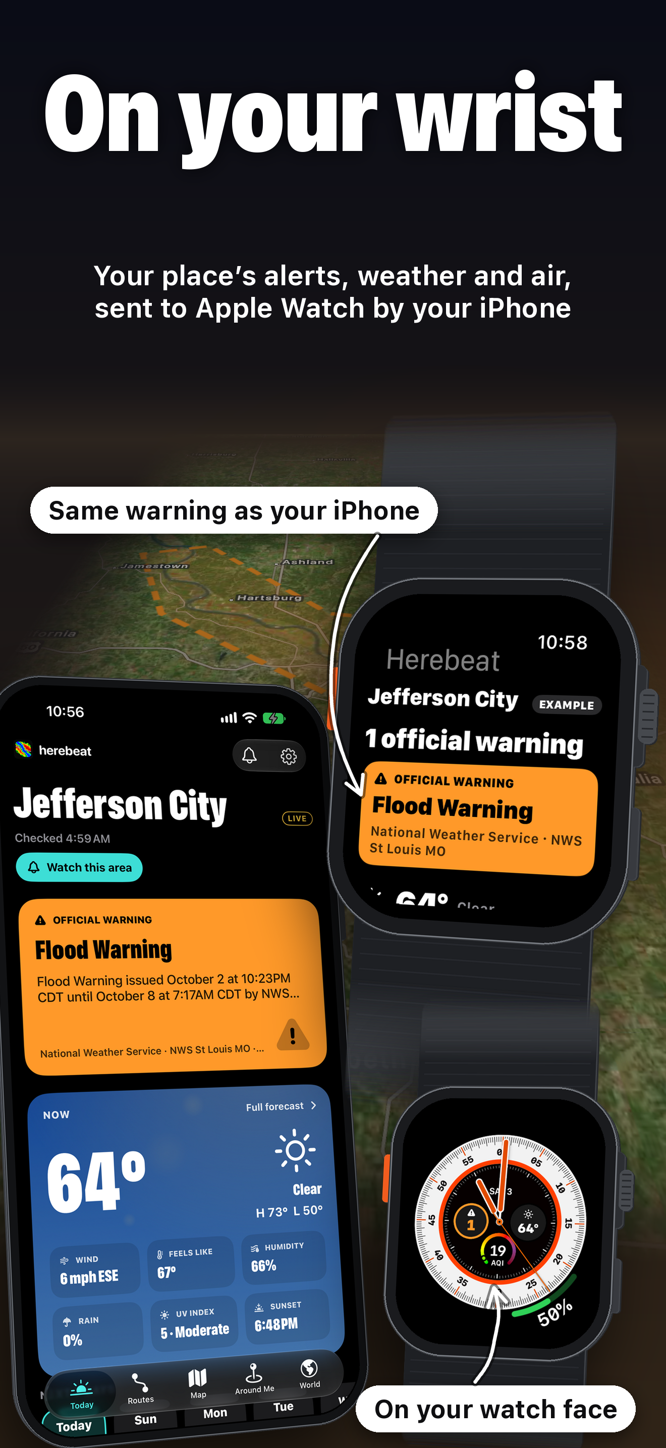
09 · On your wrist
PNG, 1320×2868, 1.6 MB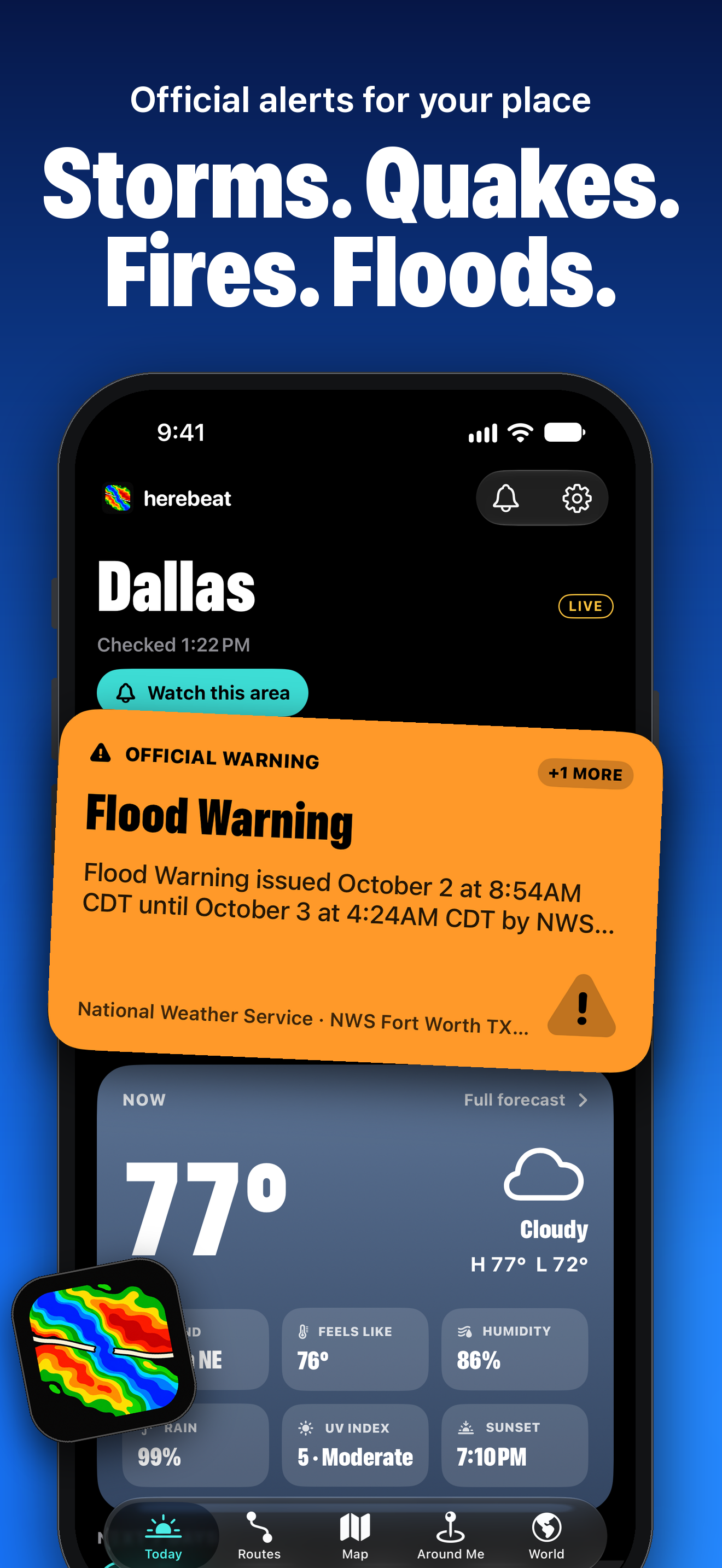
01 · Storms. Quakes. Fires. Floods.
PNG, 1320×2868, 1.0 MB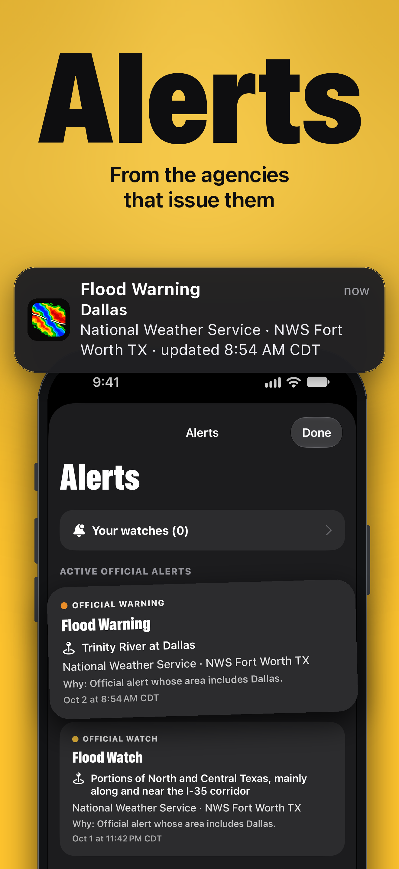
02 · Alerts
PNG, 1320×2868, 0.6 MB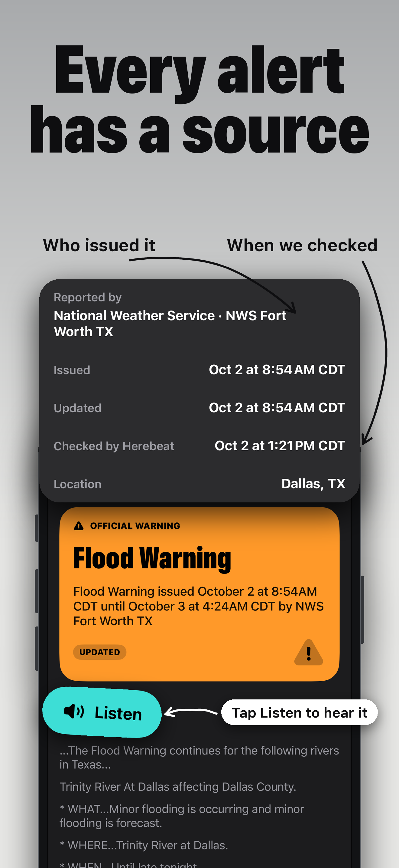
03 · Every alert has a source
PNG, 1320×2868, 0.5 MB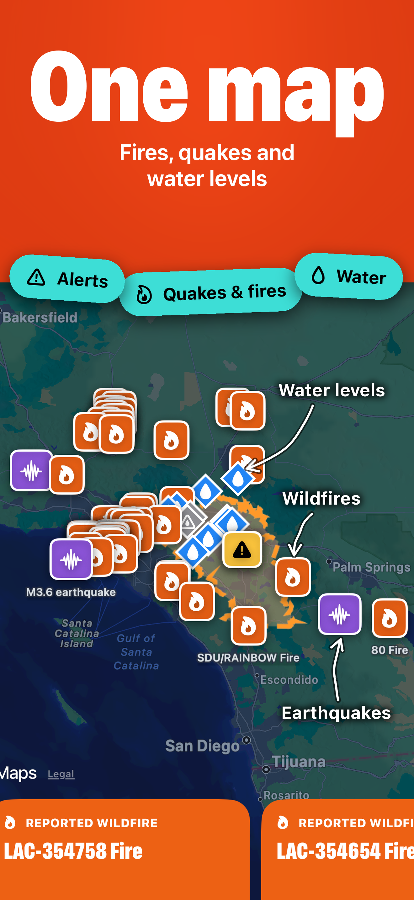
04 · One map
PNG, 1320×2868, 1.5 MB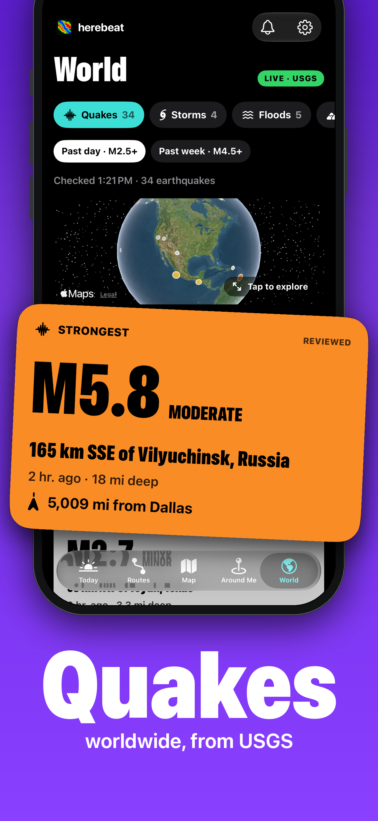
05 · Quakes worldwide
PNG, 1320×2868, 0.8 MB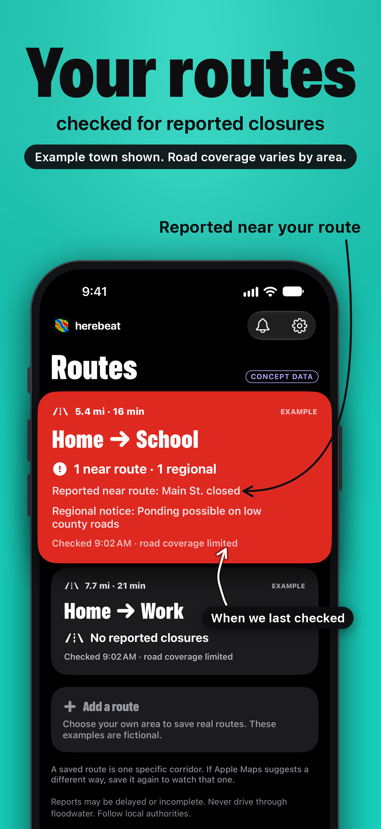
06 · Your routes
PNG, 1320×2868, 0.6 MB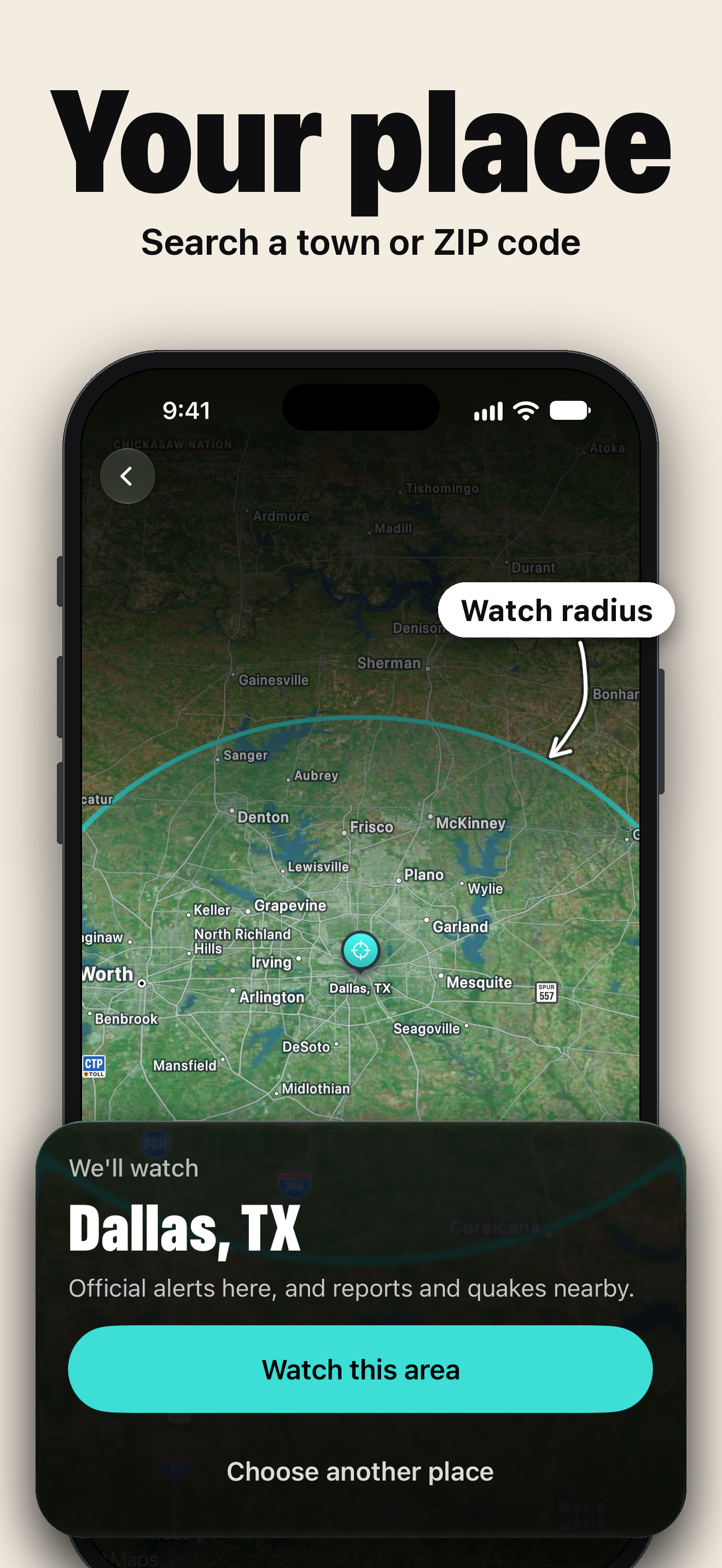
07 · Your place
PNG, 1320×2868, 2.3 MB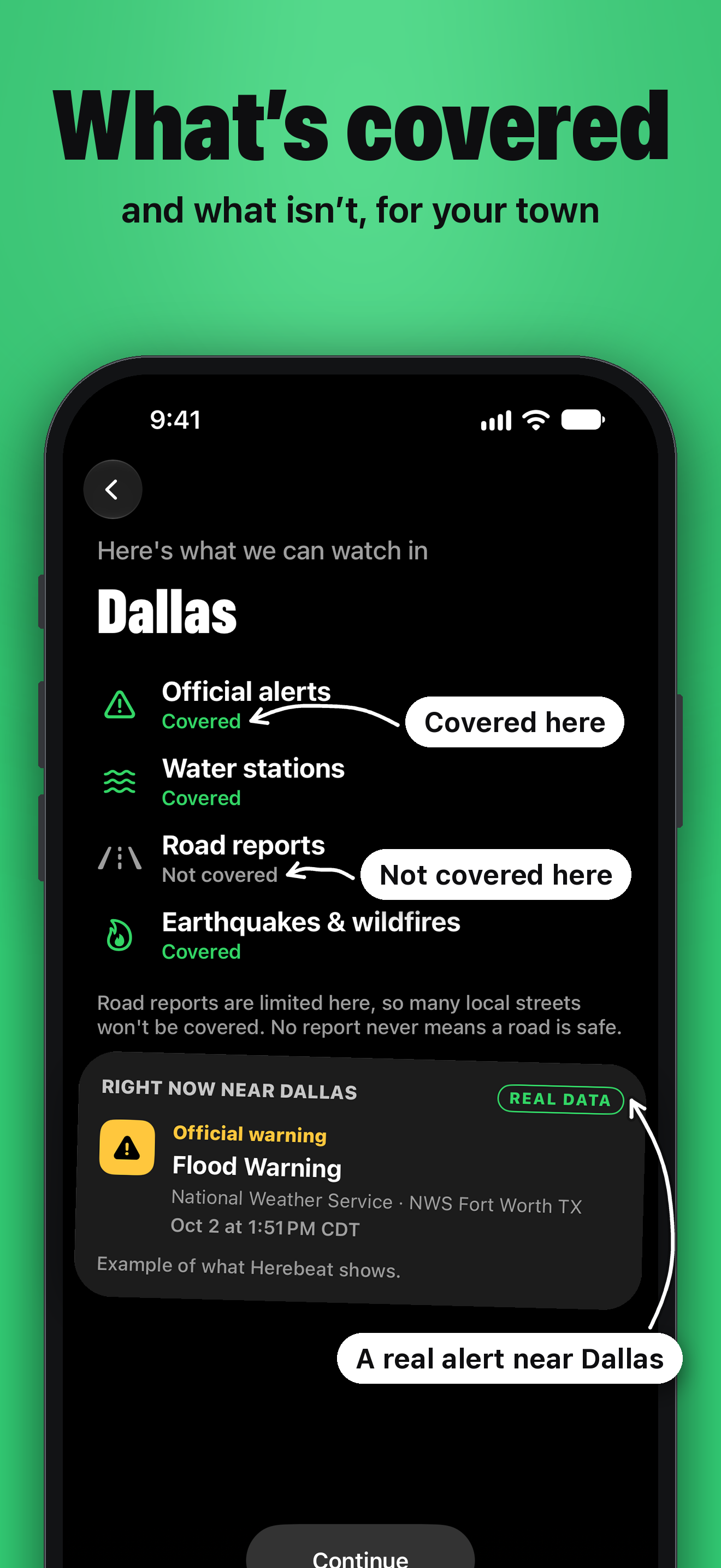
08 · What’s covered
PNG, 1320×2868, 0.5 MBFrames from real screen recordings of Herebeat 1.1, 3 October 2026, iPhone simulator at 1320×2868. All stills, ZIP, 19.3 MB
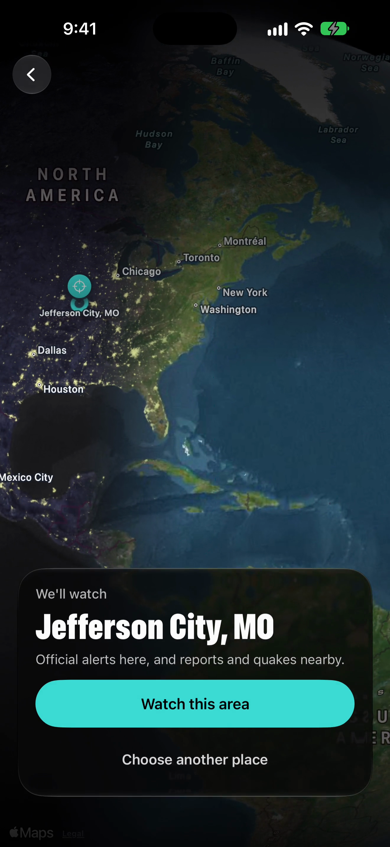
Globe turning to North America (onboarding)
PNG, 1320×2868, 1.7 MB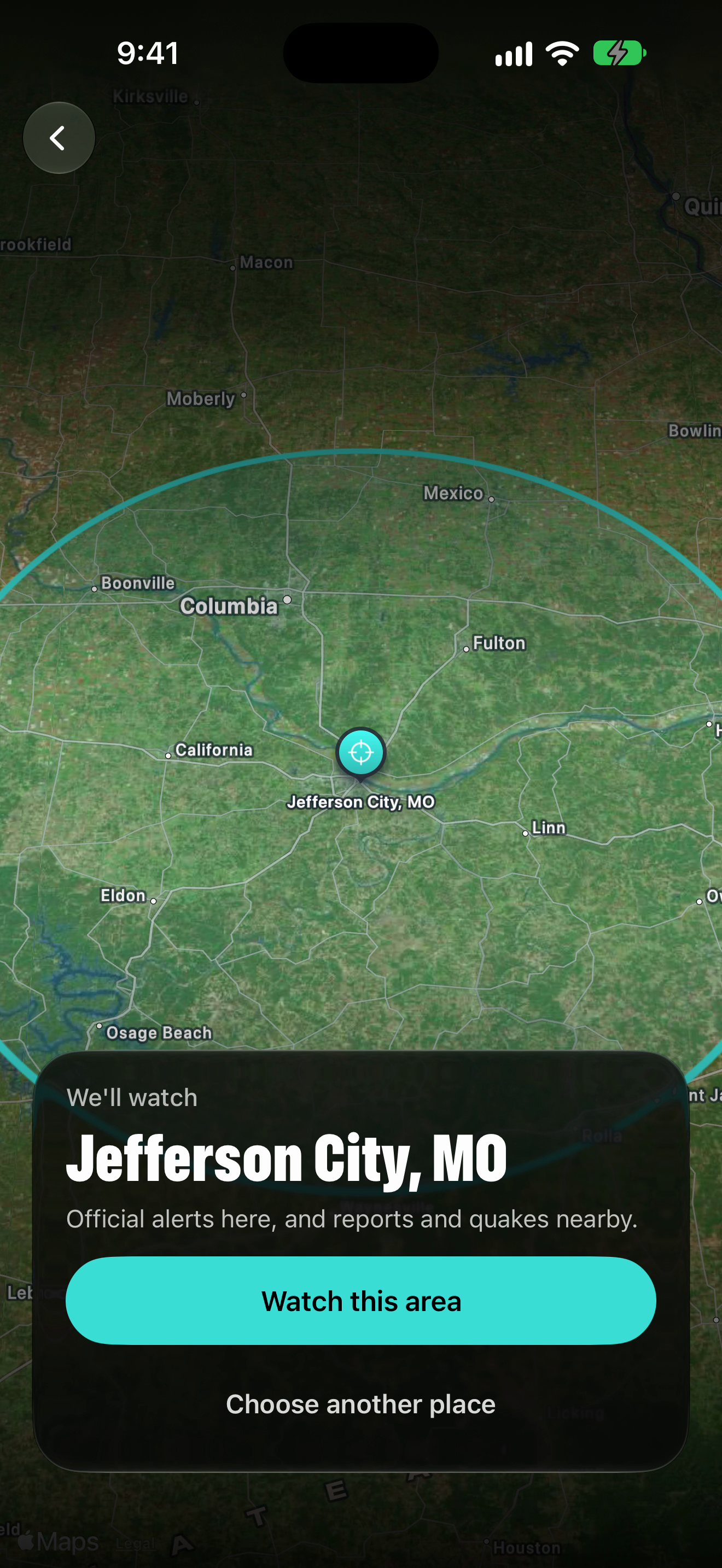
Place picked: Jefferson City, MO
PNG, 1320×2868, 3.3 MB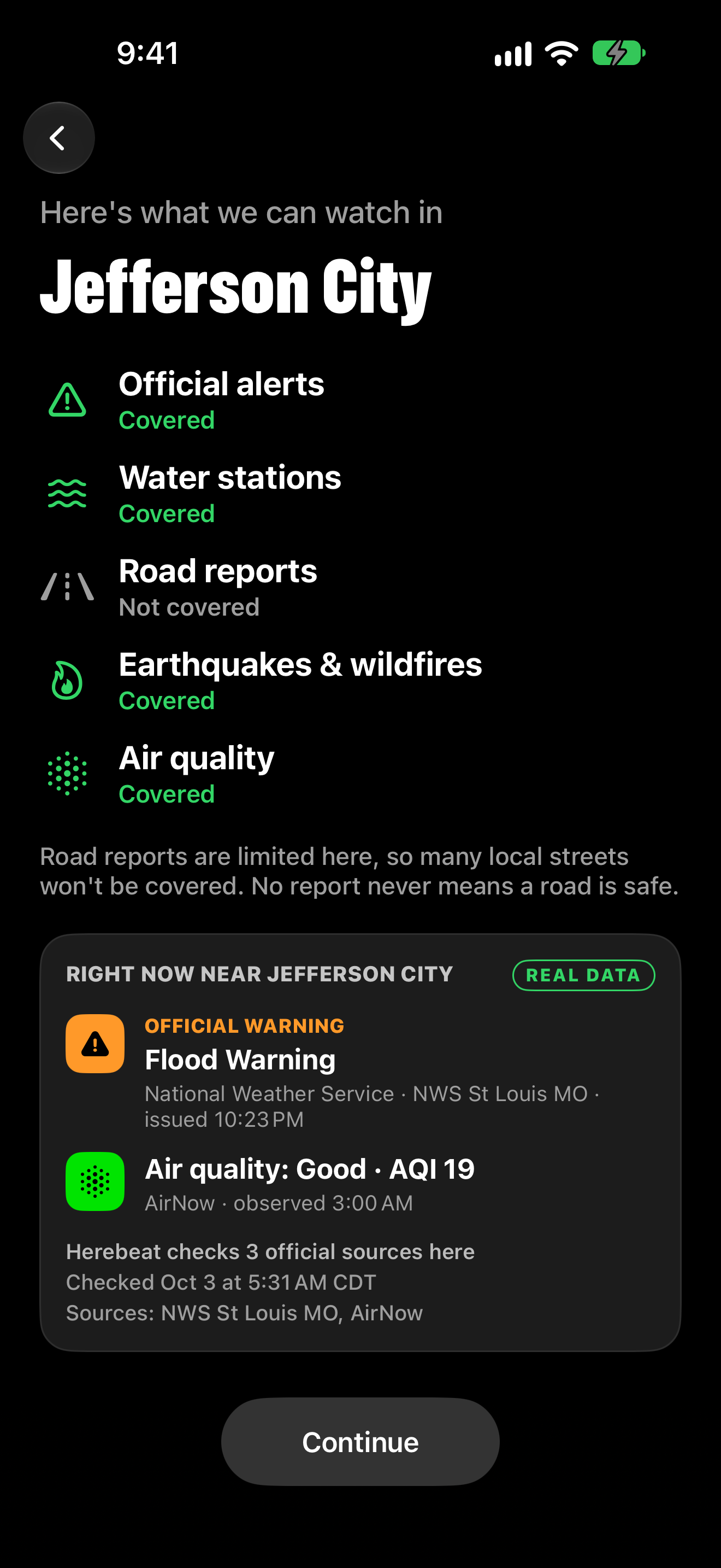
Right now near Jefferson City (onboarding)
PNG, 1320×2868, 0.2 MB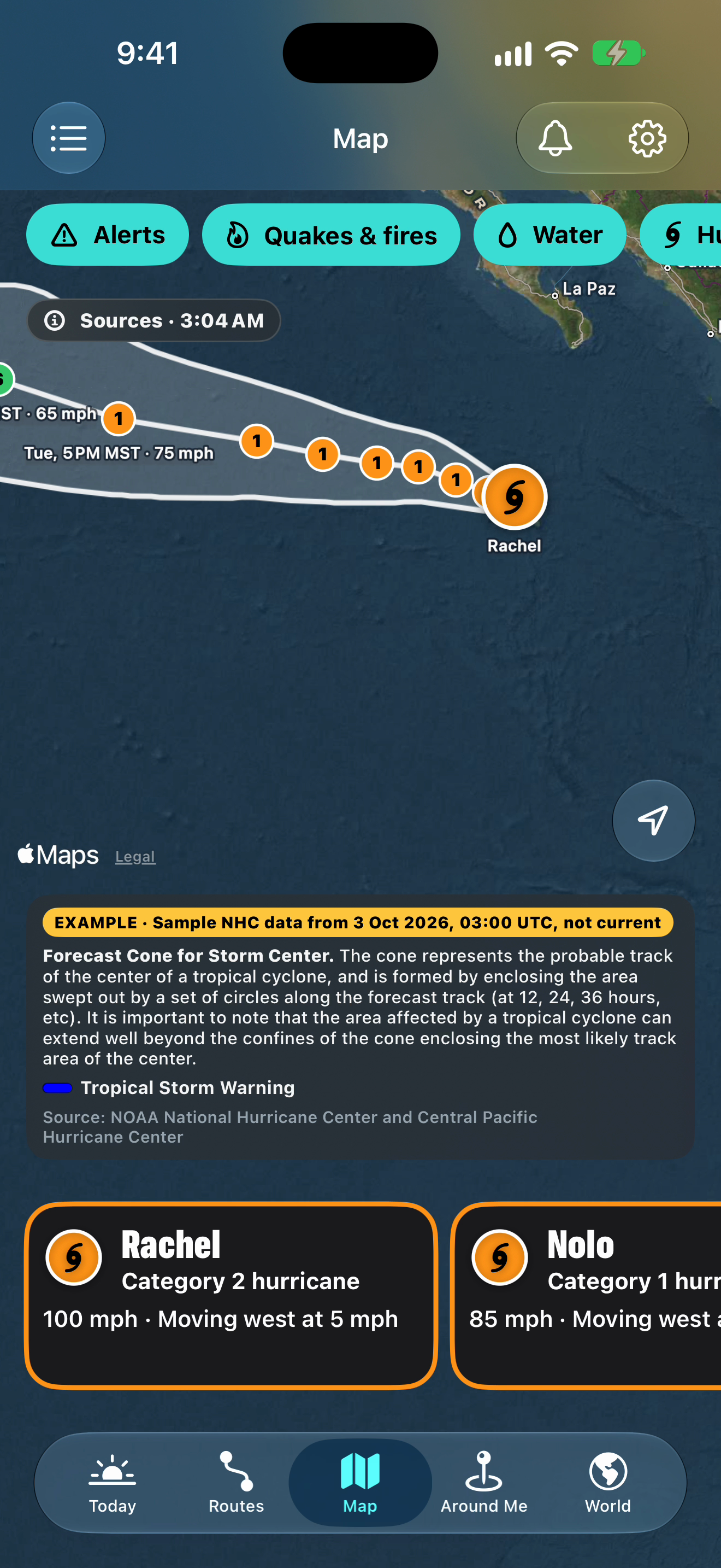
Hurricane cone and track (sample data, EXAMPLE)
PNG, 1320×2868, 1.8 MB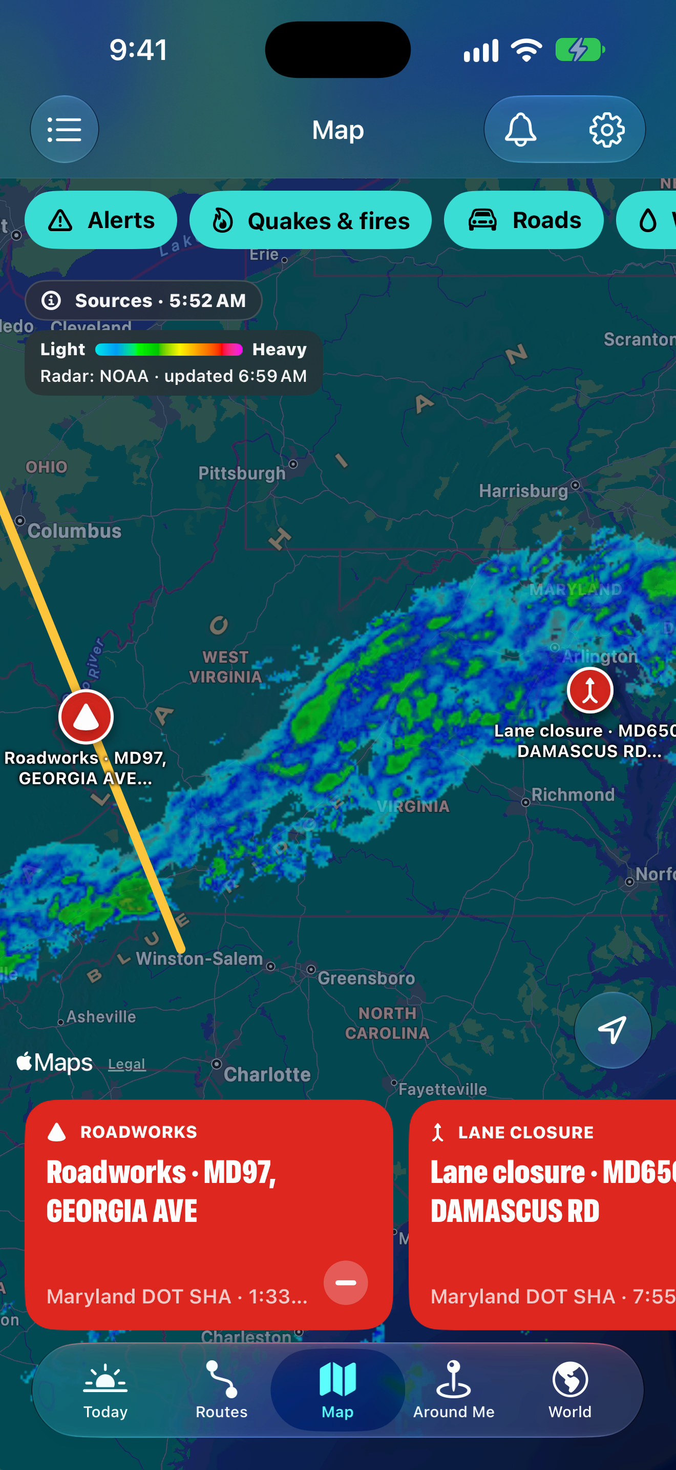
Radar over Washington, DC
PNG, 1320×2868, 2.1 MB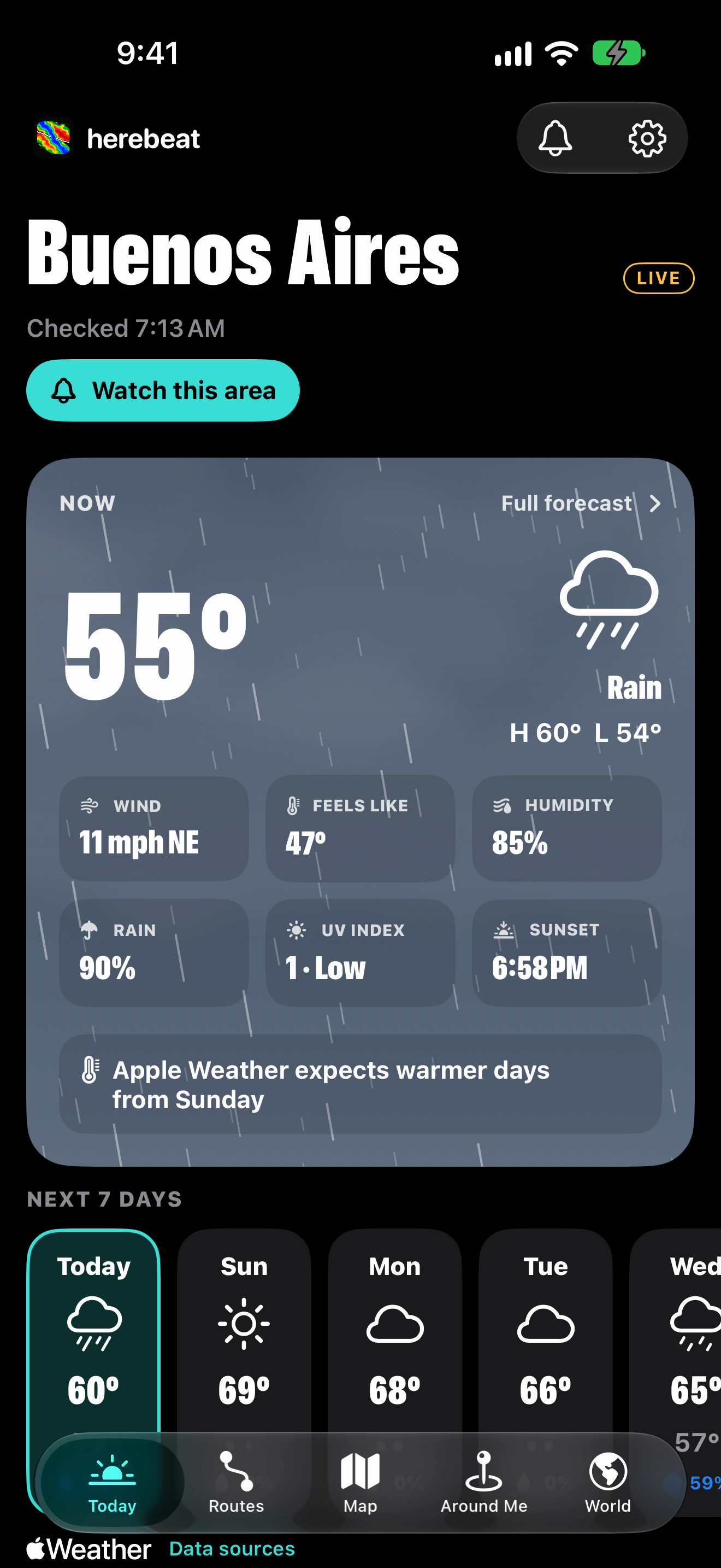
Living sky: rain, Buenos Aires (live)
PNG, 1320×2868, 0.9 MB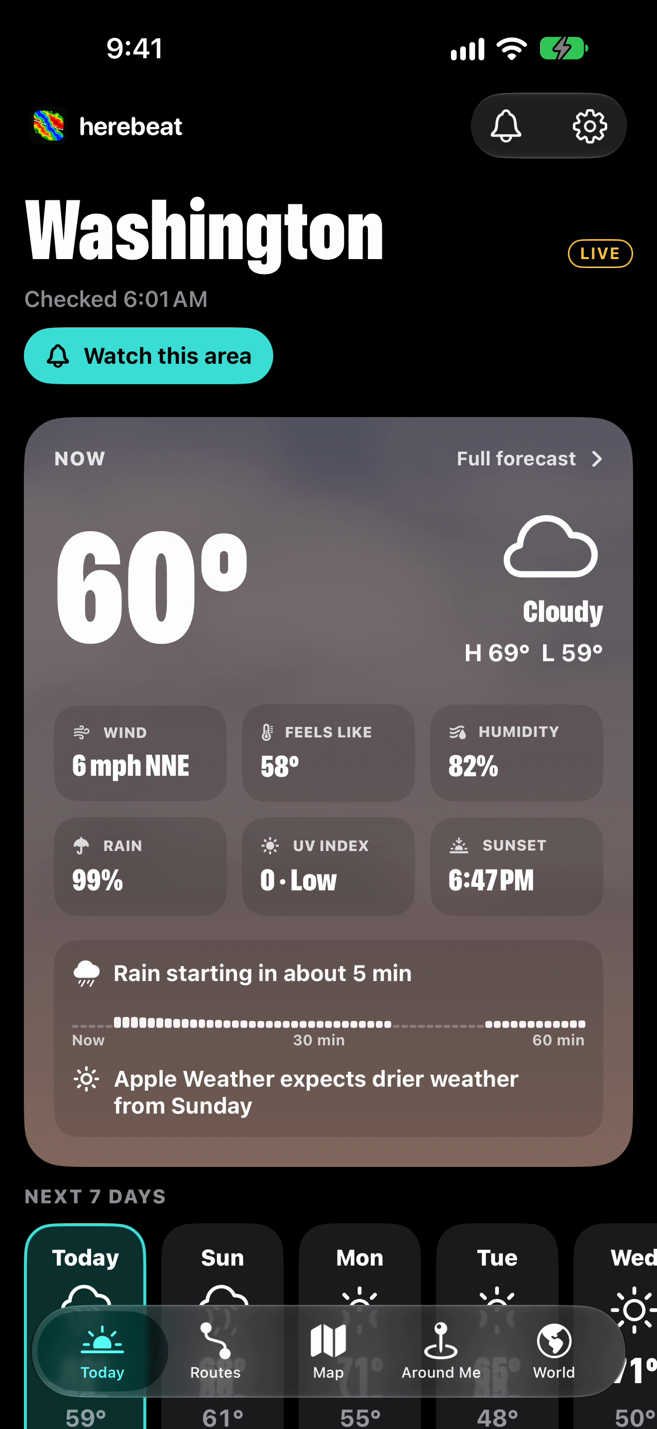
Living sky: night, Washington (live)
PNG, 1320×2868, 0.8 MB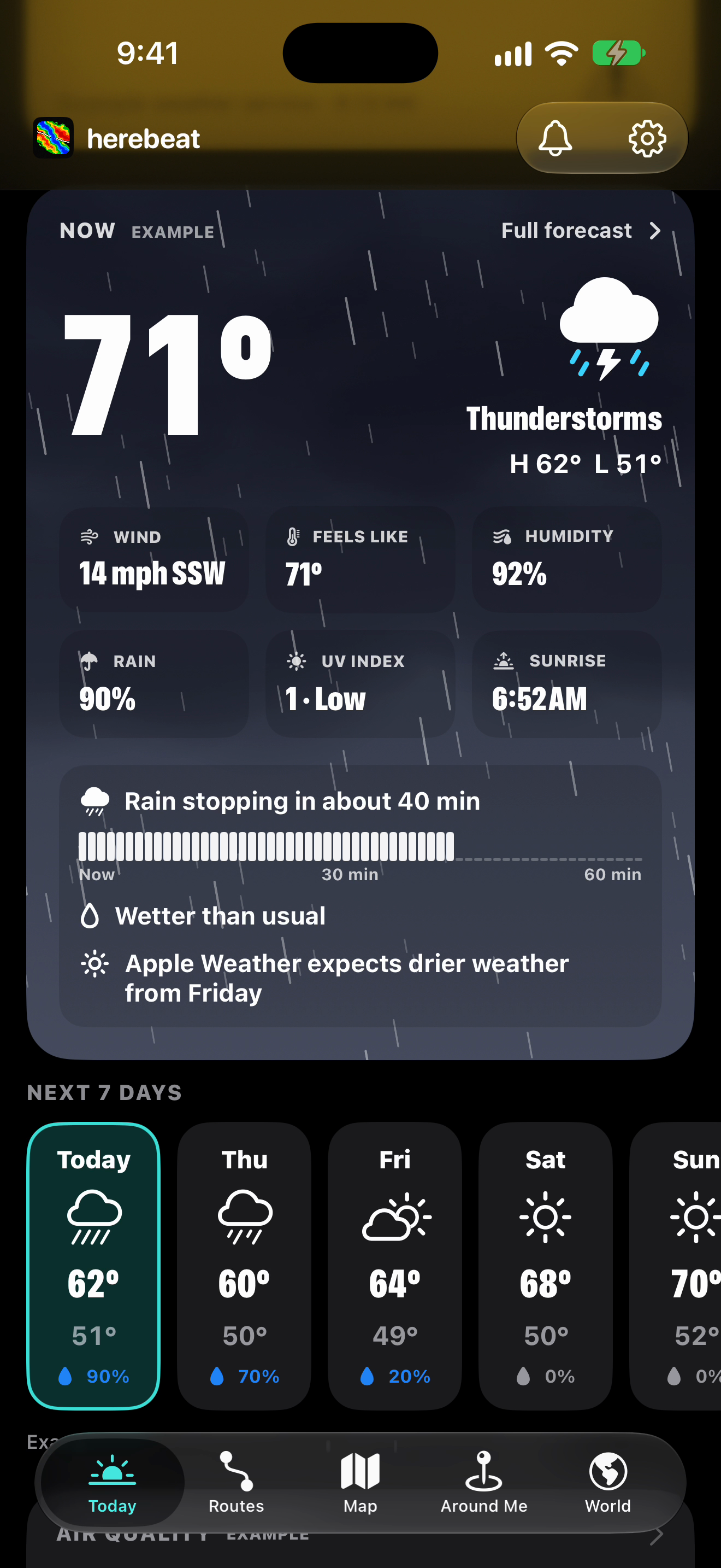
Living sky: storm (example town)
PNG, 1320×2868, 1.2 MB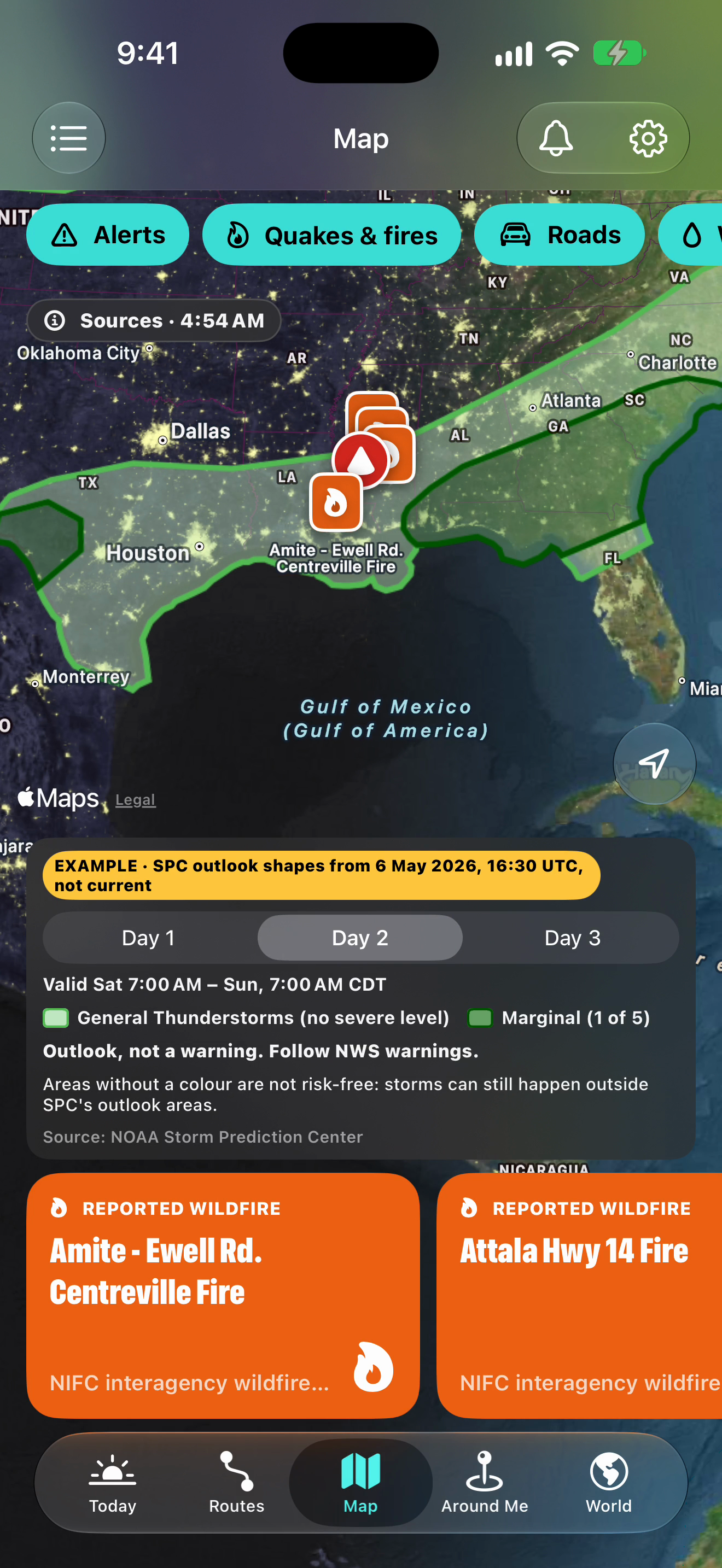
Severe outlook, day 2 (sample data, EXAMPLE)
PNG, 1320×2868, 2.2 MB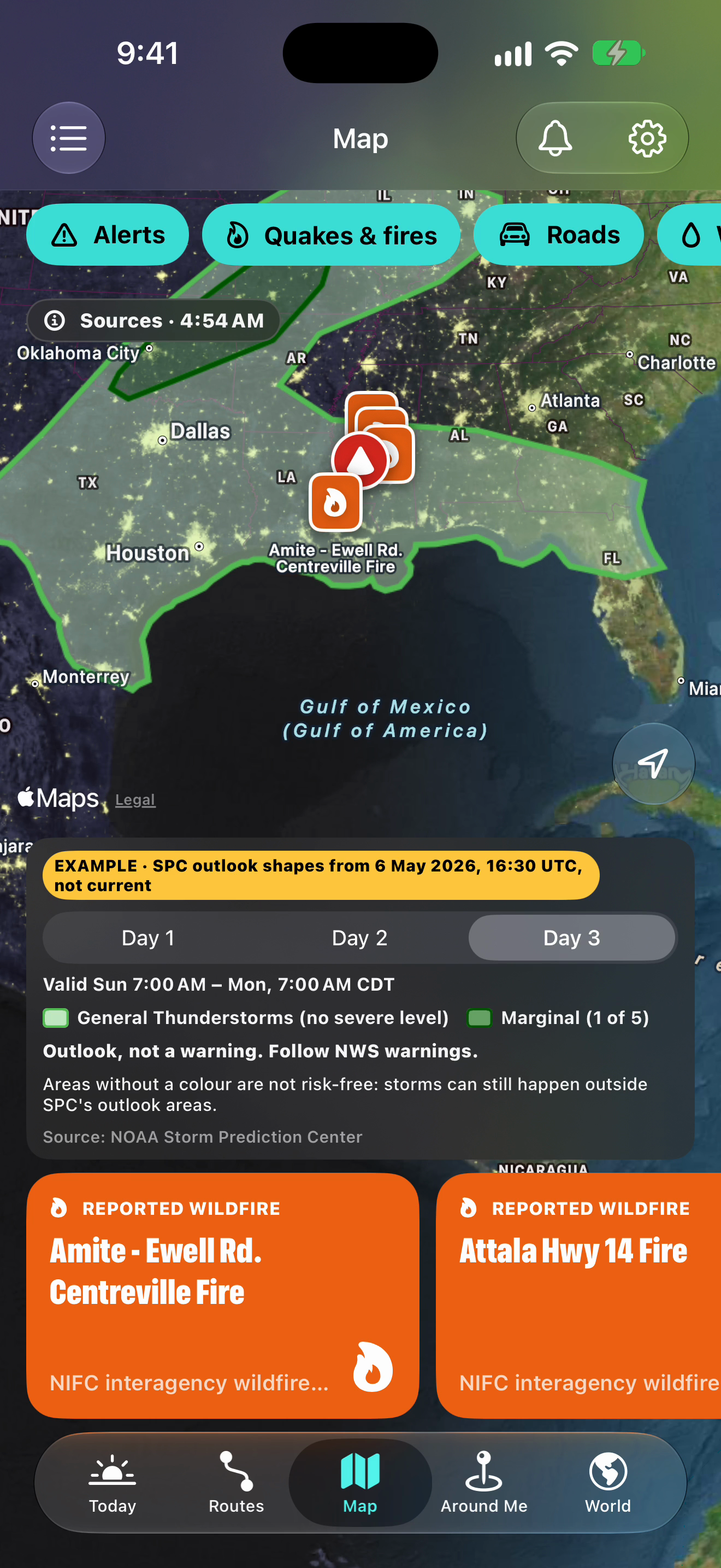
Severe outlook, day 3 (sample data, EXAMPLE)
PNG, 1320×2868, 2.2 MB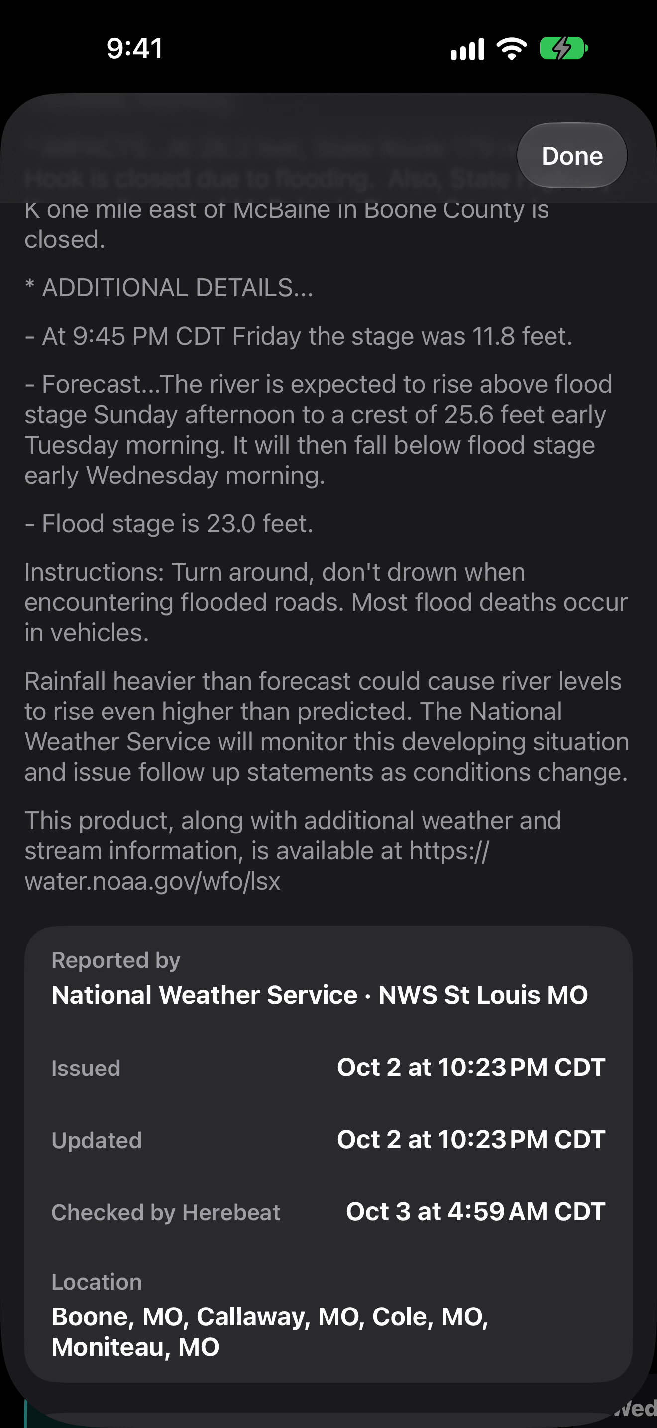
Flood Warning text, NWS St Louis
PNG, 1320×2868, 0.7 MB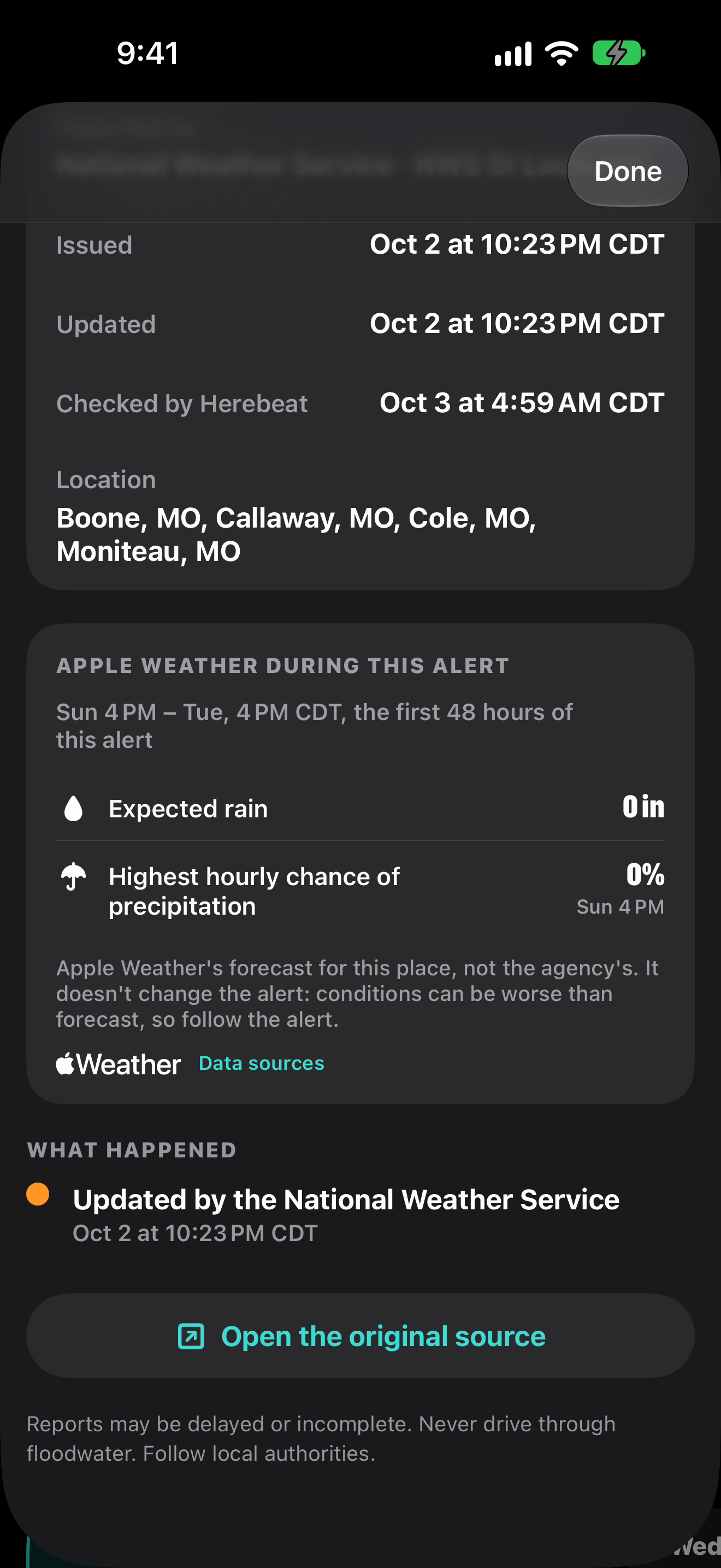
Source table and Apple Weather during the alert
PNG, 1320×2868, 0.6 MB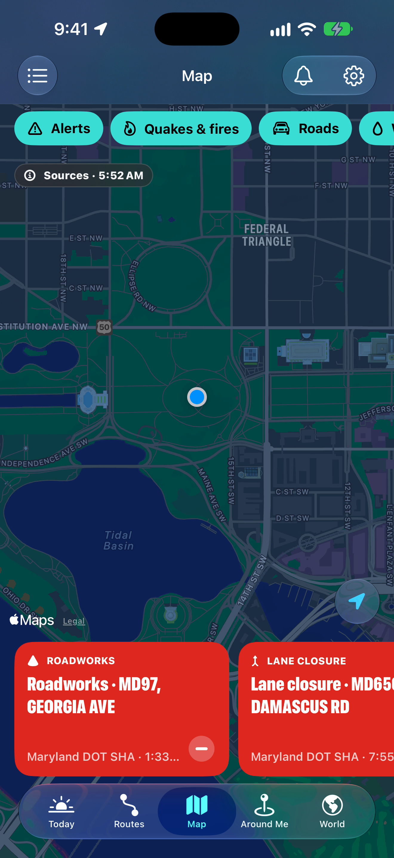
The map following your location
PNG, 1320×2868, 1.4 MB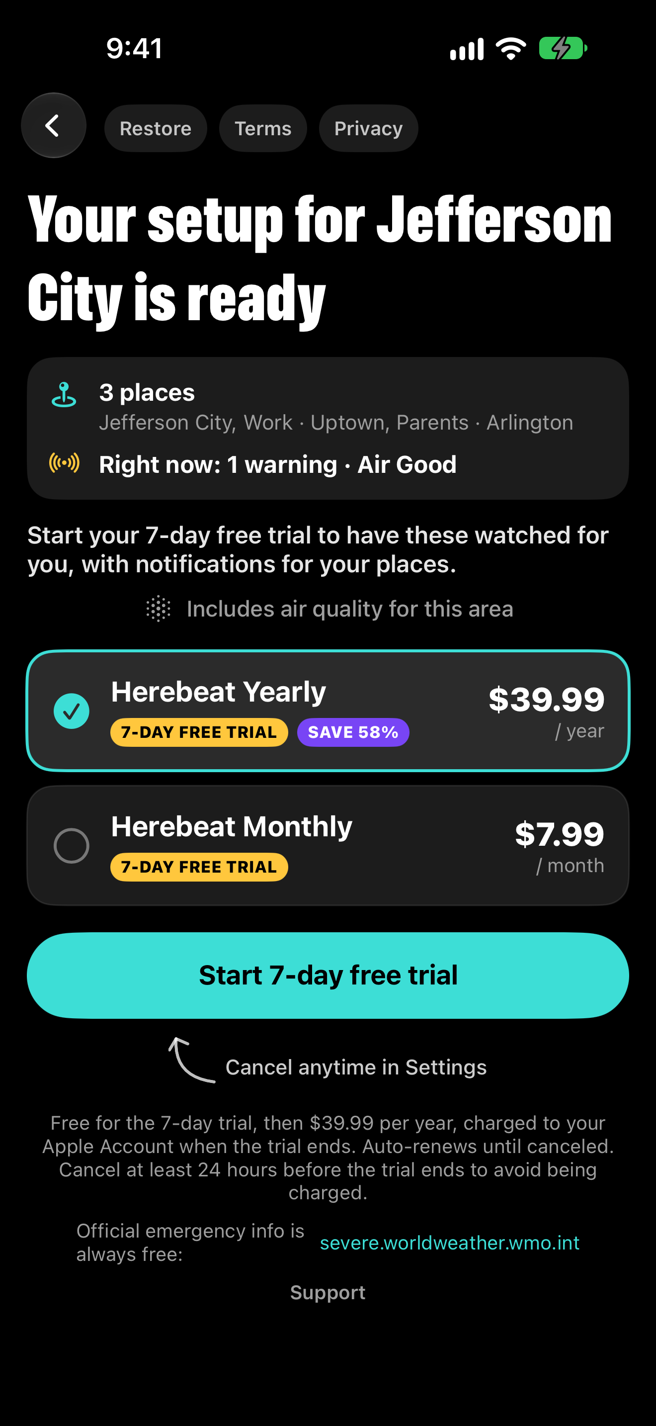
Paywall: your setup is ready
PNG, 1320×2868, 0.2 MBAll screenshots are 6.9-inch App Store images (1320×2868). The 1.1 sets and stills were captured on 3 October 2026: hurricane and severe-outlook images use labelled sample data (NHC, 3 Oct 2026; SPC, 6 May 2026), and the Lock Screen image is a rendered preview with example data (its notification banner is drawn, with the text Herebeat sends for the Jefferson City Flood Warning). The 3D set’s storm sky uses an example town. “On your wrist” shows Apple Watch screens from the watchOS simulator, replaying the Jefferson City Flood Warning (marked EXAMPLE on the watch), and the Wayfinder face with Herebeat’s complications; the watch case and band are drawn. Please keep those labels visible. Everything else is live data or a real server answer recorded that day. The 1.0 set shows real app screens with live data from 2 October 2026; its Routes image uses a fictional example town. The icon, the 1.1 screenshots and the 1.0 screenshots are in the press kit ZIP (18.1 MB); the 3D set is in its own ZIP (14.3 MB) and the stills in a separate ZIP (19.3 MB).
Press contact
Questions, interviews, review access or anything else for a story:
info@herebeat.comHerebeat is made by Nebula Edge LLC.
It shows information that official agencies publish, and it can be late, incomplete or wrong. In danger, follow local authorities and emergency services, and keep your phone’s government emergency alerts turned on. Coverage differs by place, and Herebeat isn’t affiliated with or endorsed by the agencies it shows.